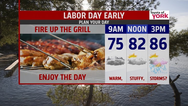
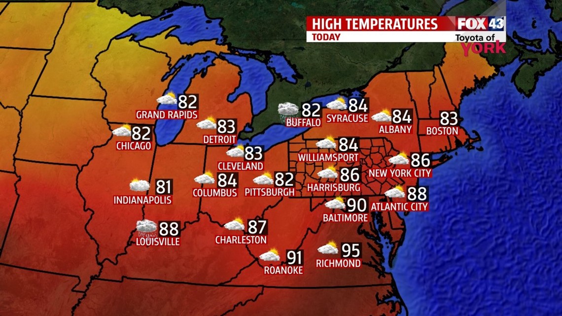
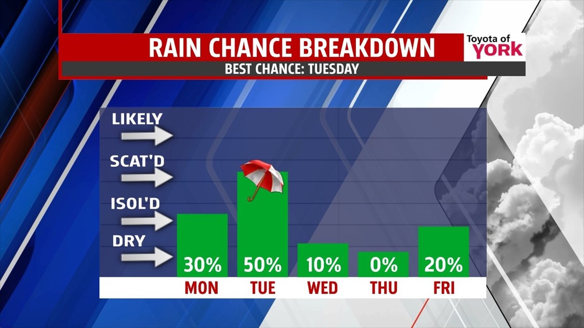
LABOR DAY: The holiday is warm and stuffy, with mostly cloudy skies and a few showers or storms in spots. It’s not an all day rain, but do be ready to heed indoors for a few while a shower passes. Highs today hit the middle to upper 80s. Keep the plans, just keep a watchful eye for rain. Tonight, we drop to near 70° under partly cloudy skies.

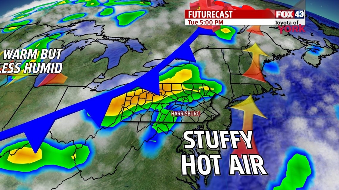
NEXT FRONT: We’re watching our next front roll in on Tuesday. Ahead of it, it’s hot and sticky with scattered clouds. Highs hit the upper 80s to near 90°. Storms fire late, before fading overnight. Some could be gusty with heavy rain.

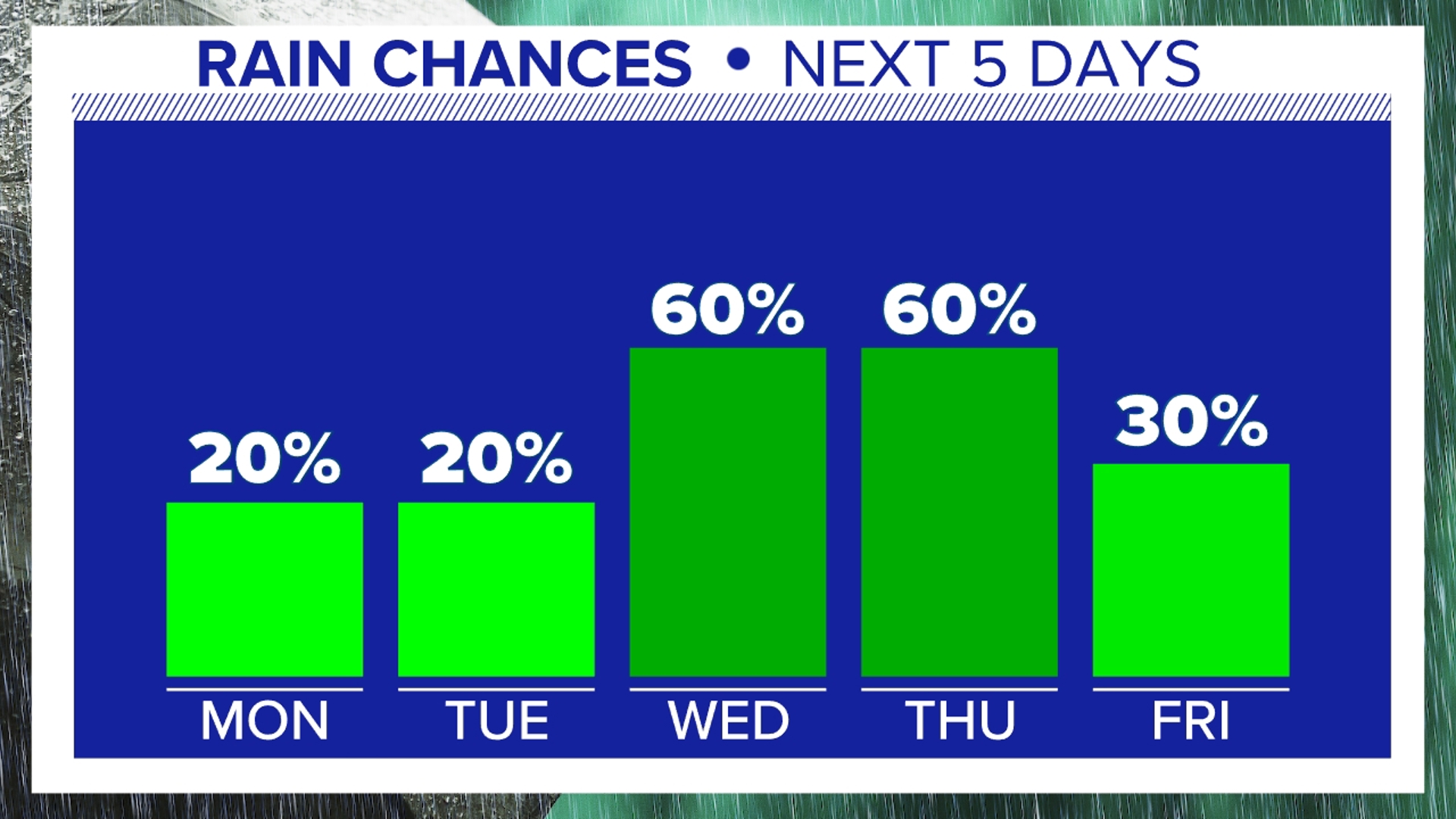
LATE WEEK: Once the front clears, we do cool off a tad, but it’s short lived. Expect highs in the middle 80s for Wednesday with sun. By Thursday and Friday we’re back to the upper 80s to near 90° respectively. Another front approaches, which could park some showers or storms late Friday.

WEEKEND: Saturday, the front works its way through. Expect mostly cloudy skies with a chance for showers and storms. Highs are in the middle 80s. Sunday, the clouds slowly clear, and it’s cooler again. Temps are in the upper 70s with a drop in humidity. Enjoy!
Have a safe and happy holiday today!
“By all these lovely tokens September days are here, with summer's best of weather and autumn's best of cheer.” – Helen Hunt Jackson
- Jeff Jumper, WPMT FOX43 Morning Meteorologist
Follow me on Twitter: @JeffJumperWX
Like me on Facebook: Jeff Jumper FOX43