
HOUSTON — Parts of Texas and Louisiana braced Monday for flooding and damaging storm surge as Tropical Storm Beta slowly worked its way into a part of the country that’s already been drenched and battered during this year’s exceptionally busy hurricane season.
The storm was no longer expected to gain hurricane strength and forecasters decreased estimated rainfall totals from Beta early Monday, saying in a U.S. National Hurricane Center advisory that up to 15 inches (38 centimeters) of rain could fall in some areas. That's down from earlier predictions of up to 20 inches (51 centimeters).
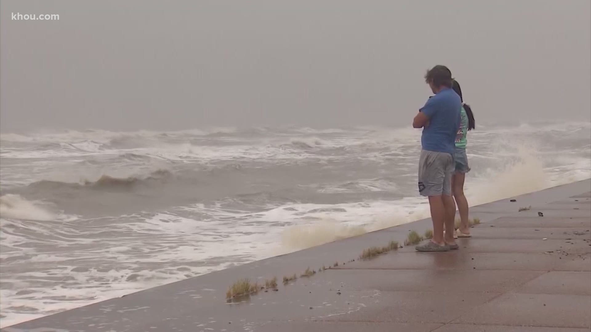
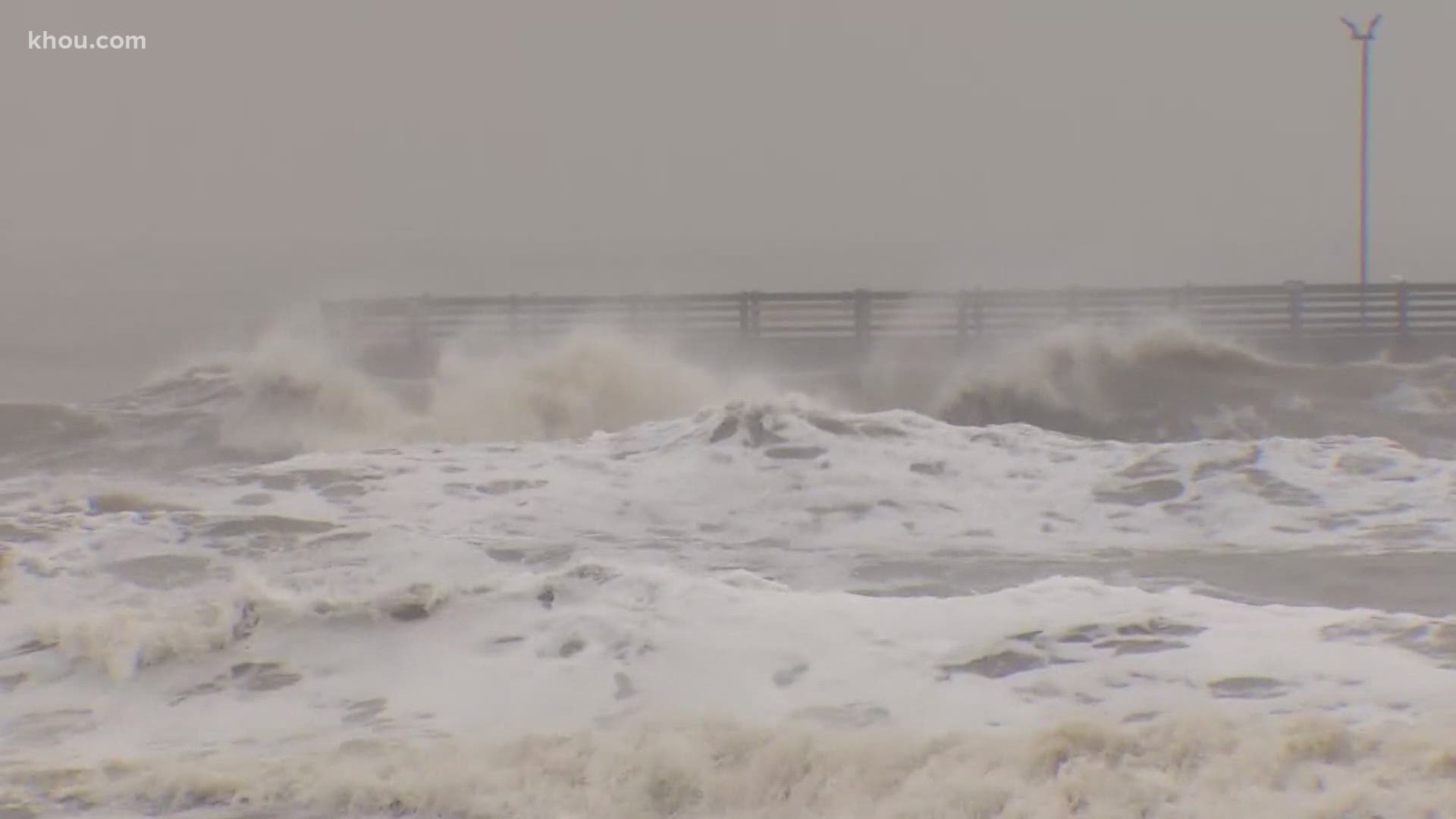
The system’s slow movement and storm surge, however, were generating concerns in coastal communities. Maximum sustained winds were 50 mph (85 kph) Monday morning. Beta was moving west at 7 mph (11 kph) at about 10 a.m. Monday, forecasters said. Storm surge up to 5 feet (1.5 meters) was forecast from San Luis Pass to Sabine Pass in Southeast Texas.
Beta was set to make landfall along Texas' central or upper Gulf Coast late Monday, forecasters said. It was then expected to move northeastward along the coast and head into Louisiana sometime mid-week, with rainfall as its biggest threat. Forecasters said flash flooding was possible in Arkansas and Mississippi as the system moves further inland.
Forecasters said Beta was not expected to bring the same amount of rainfall that Texas experienced during either Hurricane Harvey in 2017 or Tropical Storm Imelda last year. Harvey dumped more than 50 inches (127 centimeters) of rain on Houston and caused $125 billion in damage in Texas. Imelda, which hit Southeast Texas, was one of the wettest cyclones on record.
RELATED: Tropical Storm Beta: Periods of heavy rain to continue; landfall expected this evening | Watch live
The first rain bands from Beta reached the Texas coast on Sunday, but the heaviest rain wasn't expected to arrive until late Monday into Tuesday.
In low-lying Galveston, officials didn't expect to issue a mandatory evacuation order, but they advised people to have supplies ready in case they have to stay home for several days if roads are flooded.
“We’re not incredibly worried,” Galveston resident Nancy Kitcheo said Sunday. Kitcheo, 49, and her family evacuated last month when forecasts suggested Hurricane Laura could make landfall near Galveston, but they're planning to wait out Beta. Laura ended up making landfall in neighboring Louisiana.
Kitcheo, whose home is 18 feet (5.5 meters) above the ground on stilts, said she expected her street to be impassable as water from rising tides was already flooding neighboring roadways on Sunday.
“This has definitely been more stressful, this hurricane season," she said.
Galveston, which has about 50,000 residents, was the site of the deadliest hurricane in U.S. history, a 1900 storm that killed an estimated 6,000 people. The city was also hit hard in 2008 by Hurricane Ike, which caused about $30 billion in damage. Kitcheo's previous home had to be torn down after Ike.
Beta was churning slowly through the Gulf of Mexico on Monday morning about 55 miles (90 kilometers) southeast of Port O’Connor, Texas, and 75 miles (120 kilometers) south-southwest of Freeport, Texas, the U.S. National Hurricane Center said.
Forecasters ran out of traditional storm names on Friday, forcing the use of the Greek alphabet for only the second time since the 1950s.
Beta is forecast to dump heavy rain on the southwestern corner of Louisiana three weeks after the same area got pounded by Hurricane Laura. More than 41,000 homes and businesses remain without electricity, and Beta could add to that figure by toppling trees that were left leaning by the previous storm, said meteorologist Donald Jones of the National Weather Service office in Lake Charles, Louisiana.
If Beta makes landfall in Texas, it would be the ninth named storm to make landfall in the continental U.S. in 2020. That would tie a record set in 1916, according to Colorado State hurricane researcher Phil Klotzbach.
Parts of the Alabama coast and Florida Panhandle were still reeling from the effects of Hurricane Sally, which roared ashore Wednesday, causing at least two deaths. The hurricane caused about $2 billion in privately insured losses from wind and storm surge, Boston-based disaster modeling firm Karen Clark & Company estimated. That doesn’t include uninsured losses, the National Flood Insurance Program claims or damage to offshore property, like oil rigs.
Meanwhile, tropical storm winds and big waves battered Bermuda on Monday as Hurricane Teddy approached. The storm was expected to pass east of the wealthy British territory as it headed to Nova Scotia, which was under a tropical storm warning from Lower East Pubnico to Main-a-Dieu.
Teddy was about 150 miles (240 kilometers) east-southeast of Bermuda on Monday morning. It had maximum sustained winds of 90 mph (145 kph) and was moving north-northeast at 14 mph (22 kph), according to the U.S. National Hurricane Center in Miami.
The large hurricane was expected to pass some 120 miles (193 kilometers) east-southeast of Bermuda around noon Monday at its closest point.
The government closed all air and sea ports, schools and government offices for the second time in a week. Hurricane Paulette made landfall in Bermuda on Sept. 14, knocking down trees and leaving thousands without power.
___
Associated Press reporters Kelli Kennedy in Fort Lauderdale, Florida, and Russ Bynum in Savannah, Georgia, contributed to this report.