
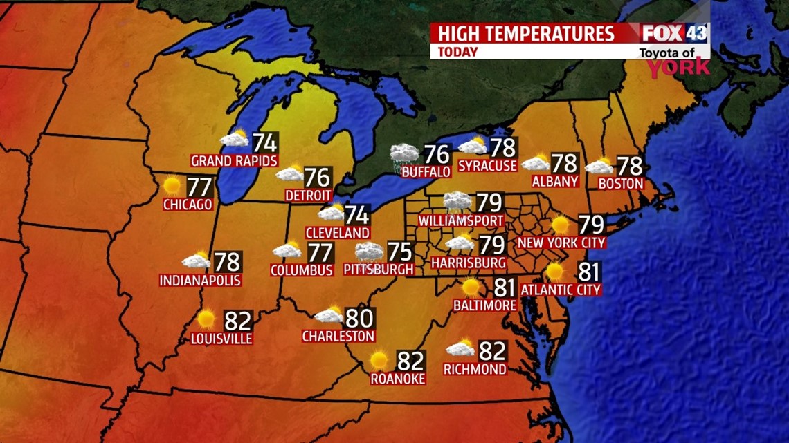
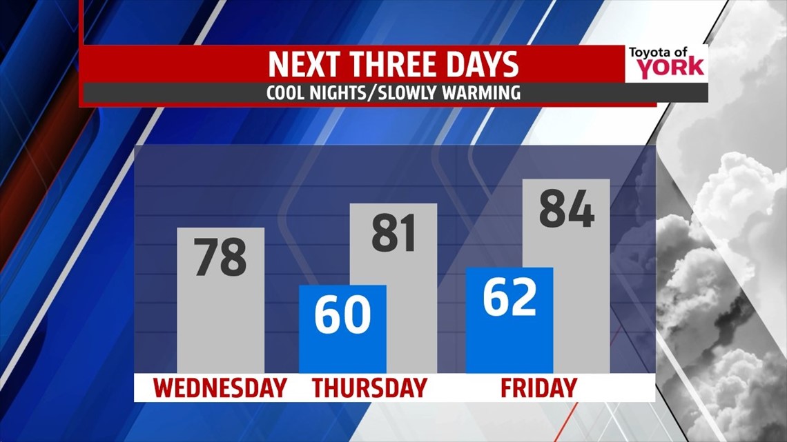
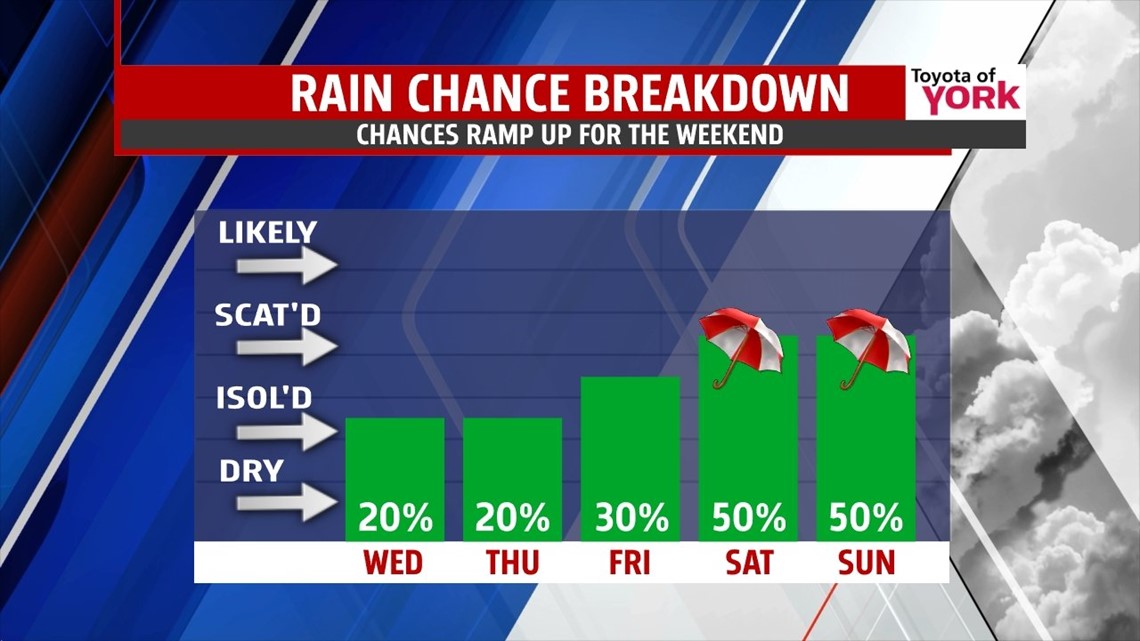
SLOW WARMING: Today, the cool pocket of air aloft keeps clouds in the forecast with some breaks for sunshine. A wave of energy swings toward us, which could fire a few showers later in the day. Highs warm a tad to the upper 70s; still below average. Tonight, we dip to near 60°.

Thursday looks to be a near repeat performance. We expect thighs a tad warmer – into the low 80s. A few showers or storms may fire in the day. Friday, we move toward the middle 80s. We increase some clouds and the rain chances bump up just a bit too, especially toward evening. Showers continue overnight.

WEEKEND: A rich flow of gulf moisture kicks in for the weekend. This will bring added clouds to our forecast for Saturday and Sunday. A wave of energy swing through on Saturday, bumping against a stationary front off the coast. This helps to fire showers and storms later Saturday into Sunday. Highs Saturday and Sunday are only near 80° with the rain. Sunday, we keep the chance for some showers and storms.

NEXT WEEK: The system slowly moves east, lingering clouds and a few showers into Monday. Highs bump to the middle 80s though. We’re clearing a bit more with middle to upper 80s for Tuesday.
Make it a wonderful Wednesday.
“The foolish man seeks happiness in the distance. The wise grows it under his feet.” – James Oppenheim
– Jeff Jumper, WPMT FOX43 Morning Meteorologist
Follow me on Twitter: @JeffJumperWX
Like me on Facebook: Jeff Jumper FOX43