
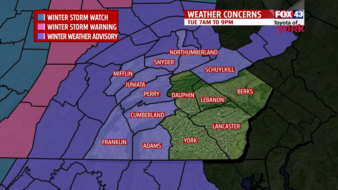
WINTER WEATHER ADVISORY
National Weather Service has issued a WINTER WEATHER ADVISORY for parts of the area for tomorrow morning from 7am until 9pm. This means traveling may be hazardous because of weather conditions. You can expect snow, sleet and freezing rain for several hours which may accumulate in some places. This will continue until temperatures warm above freezing later in the day.

QUIET AND CLOUDY OVERNIGHT
The clouds are back in place and despite the overcast skies, temperatures will still drop to the mid to upper 20s. It looks like we could see few snow showers mixing with sleet and freezing rain late in the morning commute. No accumulations are expected but it could dust roadways and surfaces causing slippery conditions.
TUESDAY-WEDNESDAY STORM
Low pressure will develop along the Gulf Coast then lift to the Northeast along the eastern seaboard into New England late Wednesday. We’ll start out with a period of wintry mix then as temperatures warm through the day, it will change to a steady, heavy cold rain.

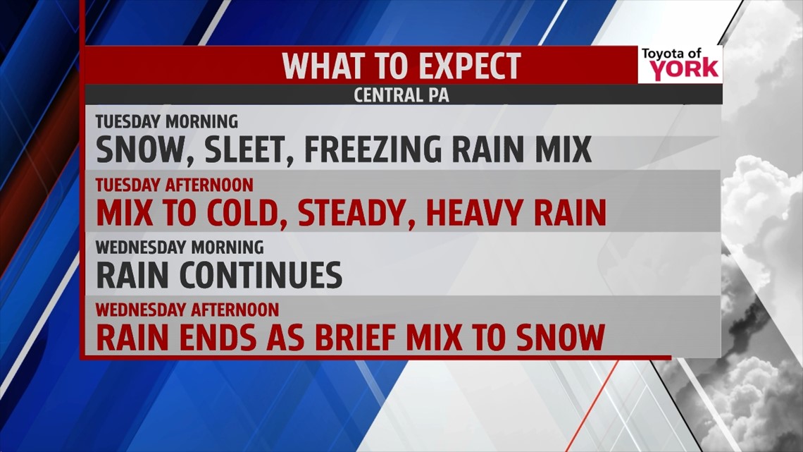
The rain will be heavy at times, especially late Tuesday into overnight Wednesday. Wednesday morning, the rain starts to taper. Winds will shift to pull in colder air on the back side as the low races. If there is enough moisture left over when this colder air dives in, we could see precipitation ending as snow. For us, this will be mainly a rain event with some light accumulations in the northwest mountains of our area.
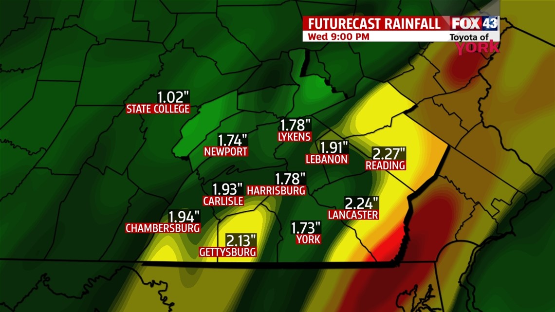
We could pick up anywhere from 1 to 2 inches of rainfall. We need to keep an eye on minor flooding potential especially where storm drains may be clogged with the recent falling of leaves.

Winter Storm Warnings are out for areas in western PA where several inches of snow is likely. This will make for slick roads with reduced visibilities early Wednesday so stay safe and plan out your travel to avoid the worst of it.
If you will be flying tomorrow or Wednesday, be sure to call ahead of time to check on travel delays.
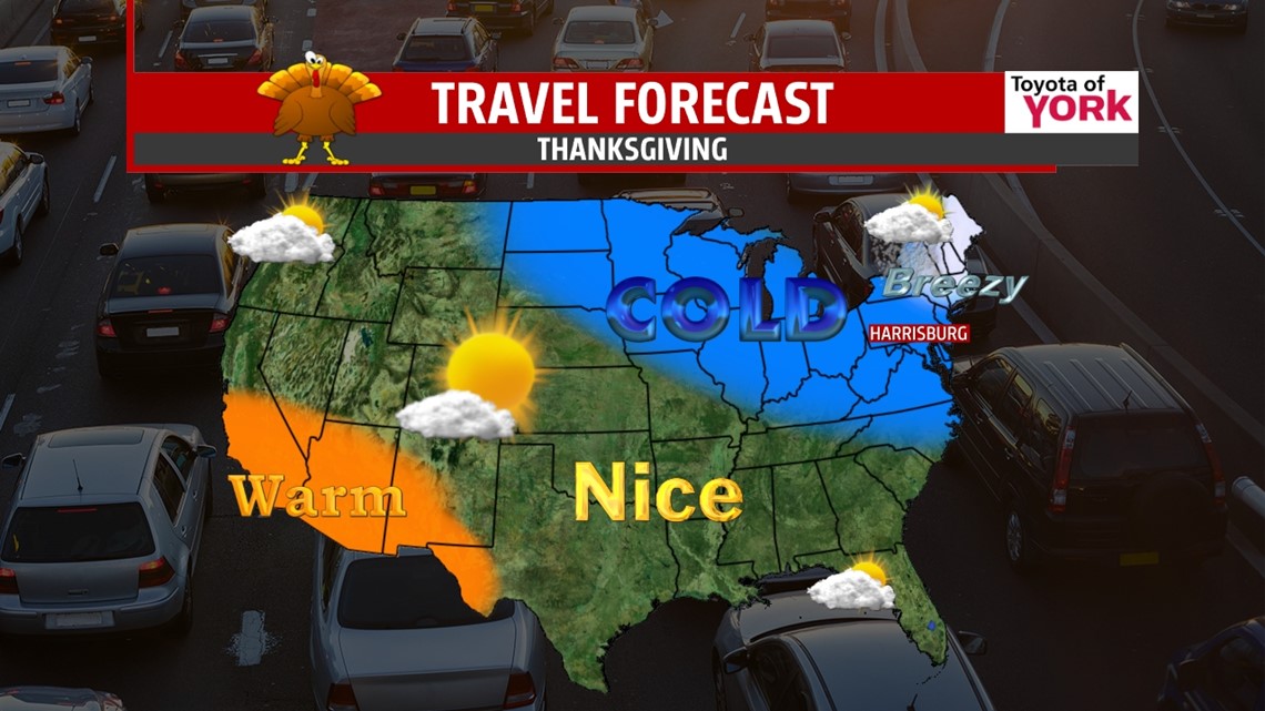
THANKSGIVING AND BEYOND: Cold air spills in late Wednesday as the precip pulls away. It will be breezy Wednesday into Thursday too. We start in the mid 20s on Thanksgiving, with sun increasing through the day and highs topping out near freezing! Overnight for those shopping, temps will be in the teens and low 20s! Friday, we only warm to the middle 30s with less of a breeze and a good amount of sunshine. The weekend looks chilly and dry with highs in the low 40s.
Stay patient and allow for extra time during your travels.

Have an awesome Monday and enjoy the shortened work week if you get to!
MaryEllen Pann, Chief Meteorologist
Like me on Facebook: maryellenpannfox43
Follow me on Twitter: @MaryEllenFox43