

HARRISBURG, Pa. — South Central Pennsylvania saw some novelty snow Thursday morning, though not enough to cause many problems areawide.
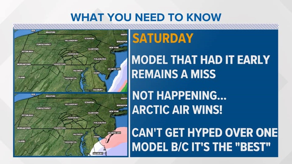
Another winter storm is expected to cause messy conditions this weekend before moving off the coast, though recent trends keep this storm far enough away that we will likely not see any impacts.
The forecast Friday and Saturday calls for rain, freezing rain, and snow in the Southeast before the storm tracks into the Atlantic on Saturday afternoon.
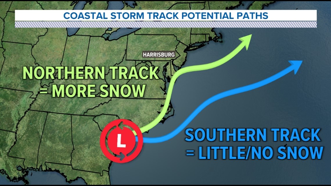
Storm track can make all the difference with these coastal storms and nor'easters.
A more northerly track that brings the center of a storm closer to PA can mean big time snow (of course cold air and other factors also need to be in place).
However, a more southeasterly track with the center of the storm farther away often means little to no impacts. This is what models are agreeing on for this weekend's system.

So what's the bottom line?
Though models showed snow earlier this week, these models have shifted farther away from our area.
It's also an important lesson in not trusting only one model! It's important to look at trends, how well a model is performing, as well as take into consideration other meteorological principles.
Bottom line: trust the experts!

Looks like we'll have to wait for the next big storm to see if we get more snow in Pa.