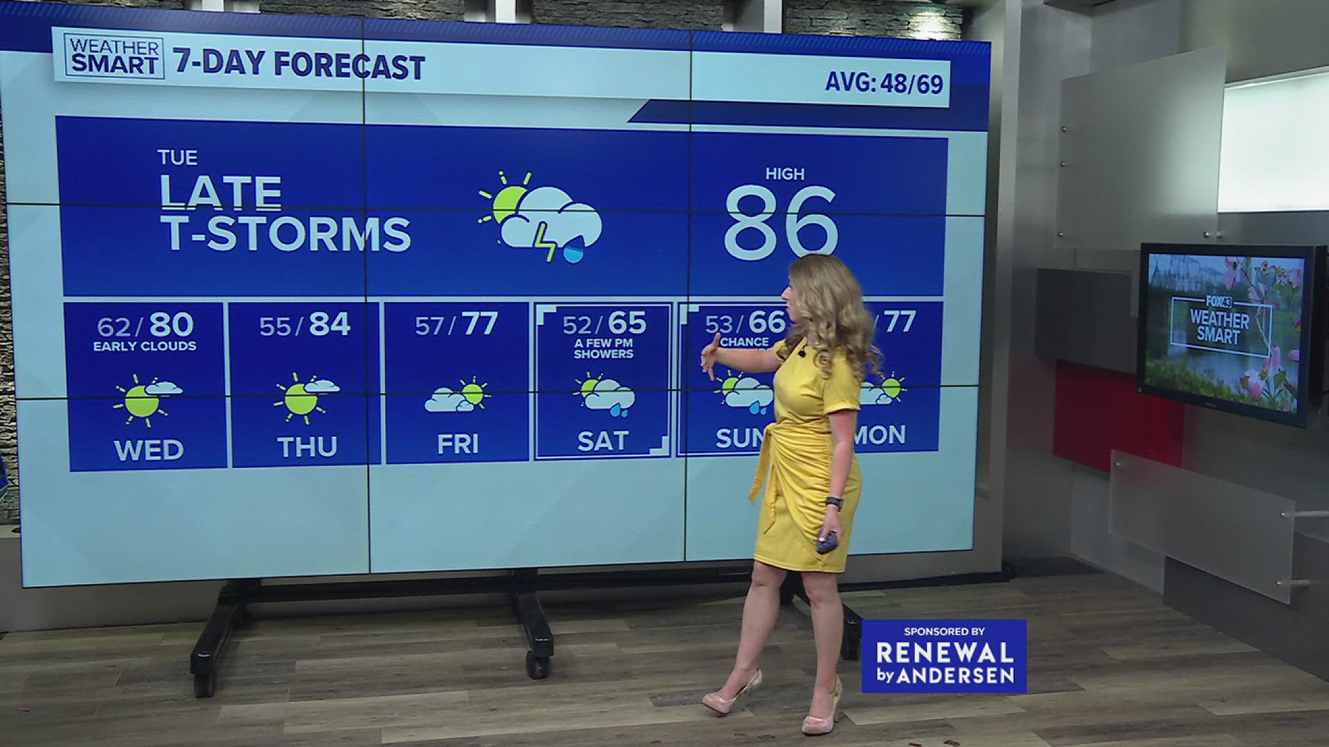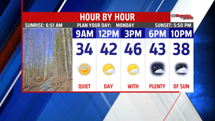

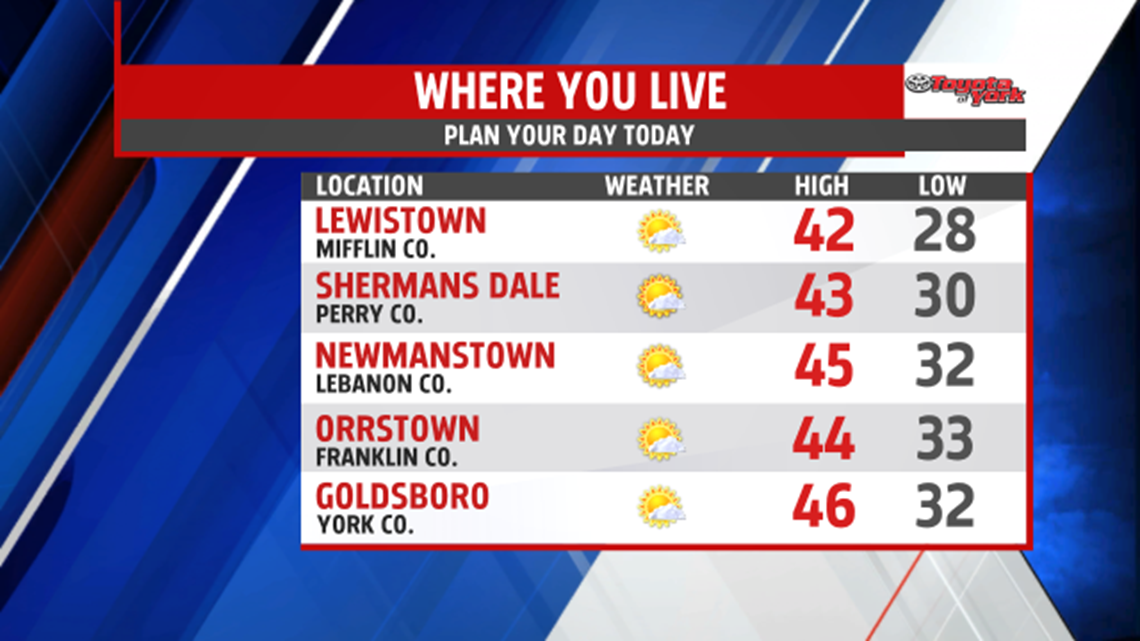


SUN STARTS WEEK: High pressure is briefly taking control of the region’s weather, bringing some sunshine to begin the week. Expect a few passing clouds during the morning mixed with some sun. Abundant sunshine is expected for the afternoon hours. Temperatures are still a bit on the mild side, in the lower to middle 40s. Clouds build through the night as our next system rapidly develops and approaches. Expect overnight lows in the upper 20s to middle 30s.

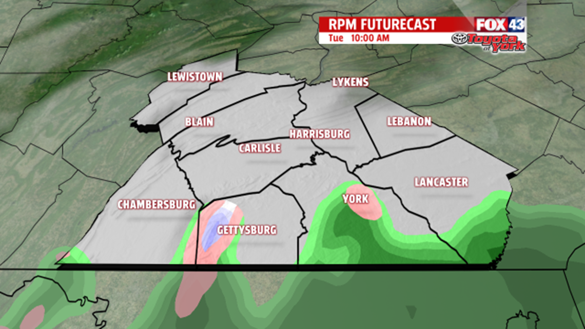
TURNING SOGGY: Tuesday brings mainly cloudy skies as our next system edges closer. Showers arrive by noon, possible starting as a brief mix for some of our west and northwestern cold spots. Otherwise you can expect plain rain showers through the day. Rain continues through Tuesday night and into Wednesday. It will be heavy at times, but flooding is not a major concern at this time. Highs Tuesday are seasonably chilly, in the upper 30s to lower 40s. Temperatures warm through Wednesday, reaching the upper 40s to lower 50s just before midnight. Highs Wednesday occur just before midnight, with readings falling into the lower to middle 40s during the morning Thursday. Temperatures peak again in the middle to upper 40s Thursday. A few rain and snow showers are possible.
SLOW DRYING: Friday is drier but cooler as well for the region. Expect a mixture of clouds and sunshine, with highs in the lower to middle 30s. A snow shower is possible. The weekend looks fairly dry overall. Expect sunshine and clouds. Highs jump from the 30s Saturday into the 40s on Sunday.
Have a great Monday!