
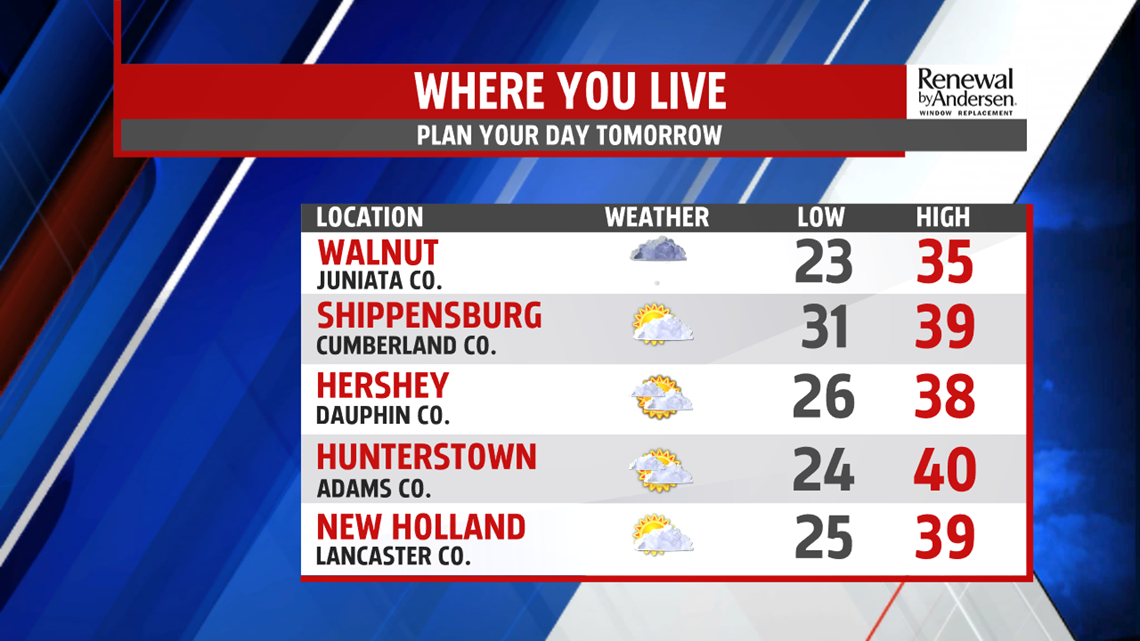
THE MIDDLE PART OF THE WEEK: We keep the additional cloud cover for the next several days. Still, temperatures drop into the mid-20s overnight into Wednesday morning. A very low chance of morning snow in our farthest northern spots is possible, with no accumulation likely. Southeast light winds persist with afternoon highs just shy of 40-degrees by the afternoon. Thursday shapes up much the same with mostly cloudy skies and a wind shift to out of the west-northwest. A very late snow chance should hold off until after midnight into Friday morning.
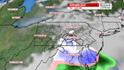

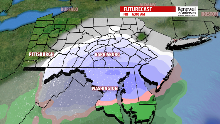
POTENTIAL MIX CHANCE DIMINISHES: The very early snow chance turns into a potential mix the further we press into Friday morning. Most of the precipitation misses us to the south. Morning lows stay around the freezing mark. Temperatures rise eventually to lower 40s by the afternoon. We’re watching this closely with cloudy skies. Stay tuned for updates as we press on through the week.
HEADING INTO THE WEEKEND: Temperatures begin in the low-to-mid 30s Saturday and rise into the low-40s by afternoon. More precipitation looks likely Saturday, mostly in the form of rain throughout the day. This ends heading into the later part of the day as we dry out into Sunday morning with lows in the mid-20s. Another nearby system could pose a threat heading into next Monday. Stick with the FOX43 Weather Team for updates in the Weather Smart Forecast.
Stay “Weather Smart” with the FOX43 Weather team all week long!
-Chief Meteorologist MaryEllen Pann