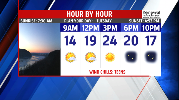

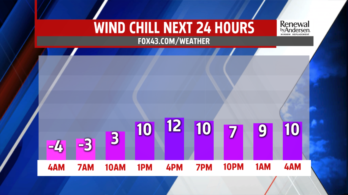

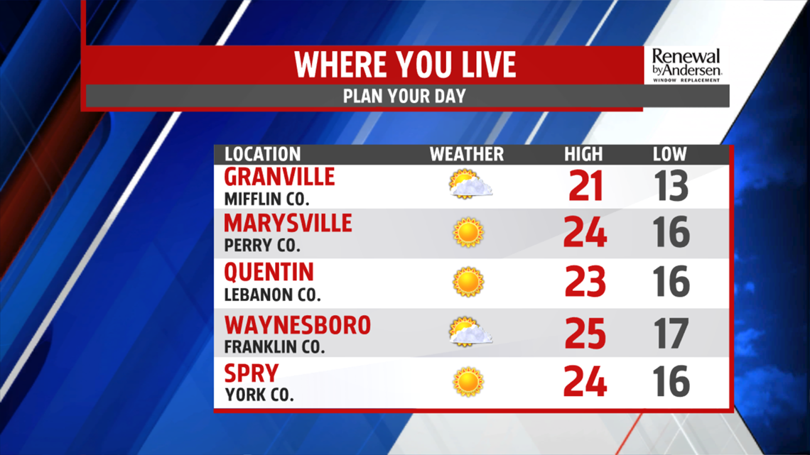
MINOR IMPROVEMENTS: It’s another bitterly cold start throughout the region, with temperatures in the single digits for many again. Wind chill values are below 0 again too, when light winds are taken into account. Otherwise, there’s some clouds to start, but they fade fast. Expect plenty of afternoon sunshine, with readings in the lower 20s. Winds remain quite breezy, so wind chill values feel like the teens for the area. Skies are mostly clear through the night. The winds finally calm too, and temperatures are a bit less frigid. Wind chill is not a factor due to the light to quiet winds. Expect overnight low temperatures in the single digits to near 10 degrees.

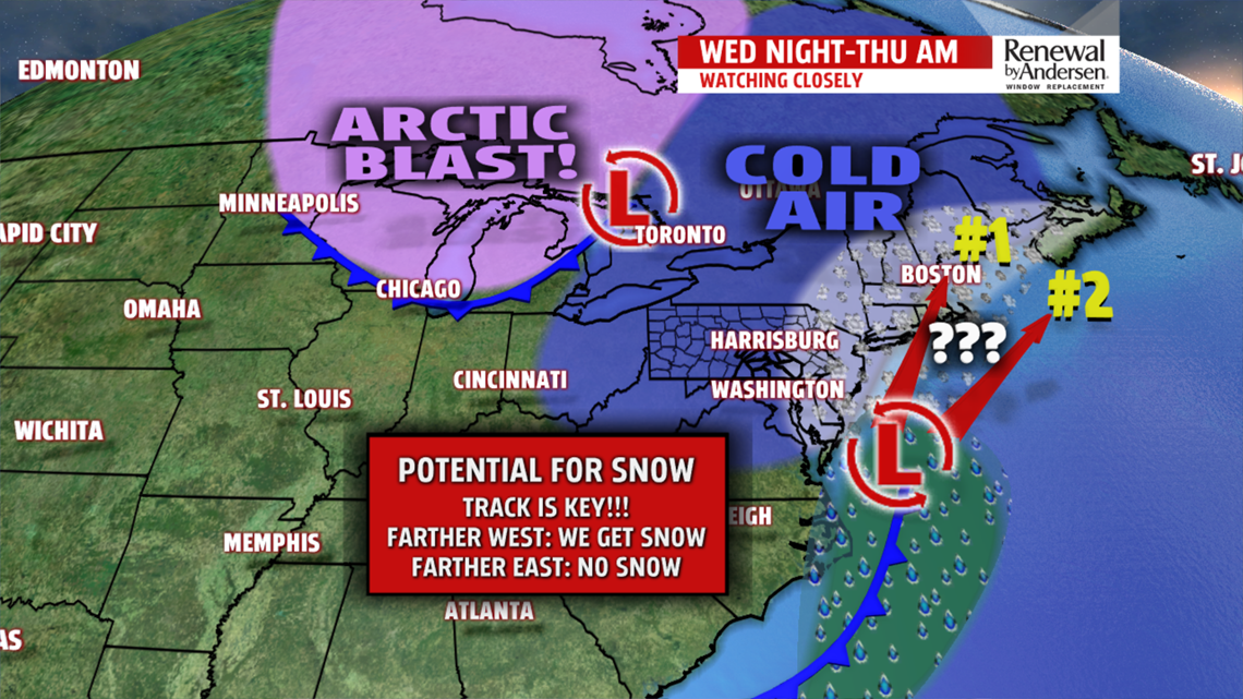
NOT AS FRIGID/SNOW?: After a sunny start Wednesday, clouds increase during the afternoon. We catch a break from the breezes, and temperatures are even a bit higher! It’s no significant warm up, but readings reach the middle to upper 20s. Perhaps a couple spots touch 30 degrees. We’re watching a developing coastal system for Wednesday night into Thursday morning. There’s a chance it clips eastern parts of the area. There’s the potential for absolutely nothing to some snow showers, or even a period of light snow east. It’s still very uncertain, but we’ll continue to monitor trends. It depends on how quickly the next burst of arctic air moves into our area. Either way, it’s breezy, with highs in the 20s and wind chill values back into the teens.

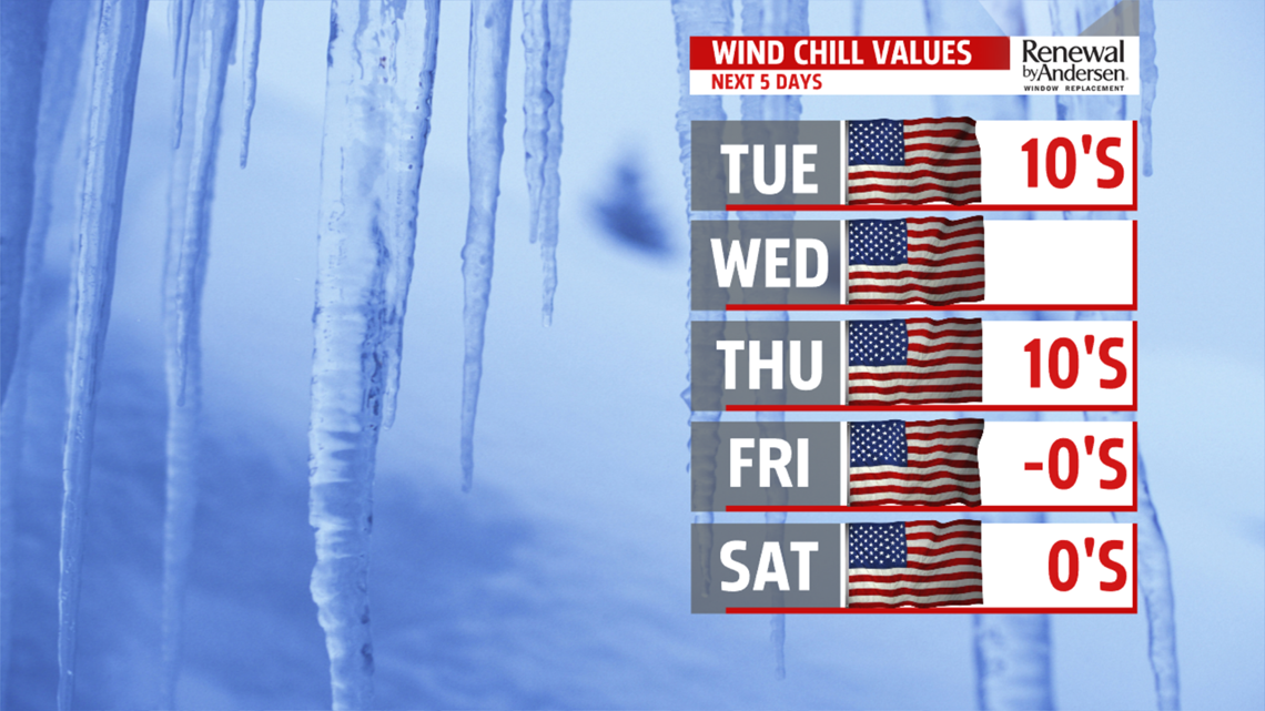
ANOTHER ARCTIC BLAST: The bitter cold and strong breezes are back again for the weekend! Friday brings partly sunny skies, and bitter cold temperatures in the lower teens. Wind chill values are brutal, in the negative single digits. Saturday brings more sunshine, but still some breezes. Temperatures are in the teens again. Wind chill values are in the single digits. Sunday shows some small moderation in temperatures. Expect readings in the upper teens to lower 20s. Of course, mornings get a brutally cold start too. Morning lows begin in the single digits, and could even dip below 0 for a few spots. Monday continues the thaw. Skies are partly sunny upon the approach of the next system. Temperatures jump above the freezing mark!
Have a great Tuesday!