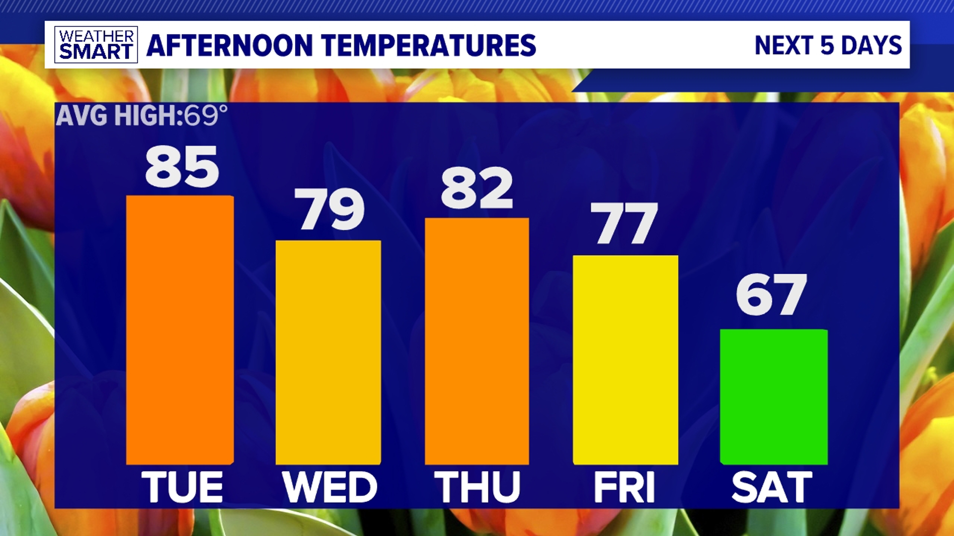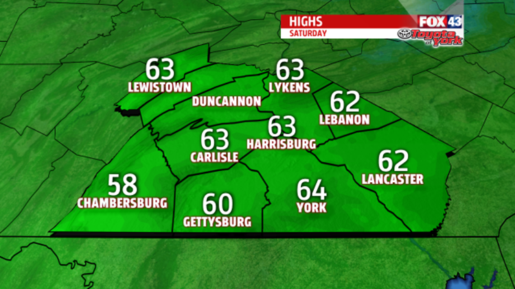
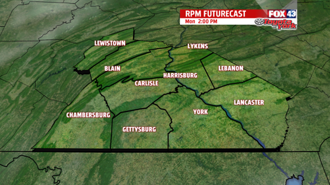
WEEKEND WARMUP: We got highs in the 60s on Saturday. Quite a change from highs in the 20s last Saturday! For your Sunday afternoon, expect highs in the upper 50s to low 60s, clouds, and a passing shower. You’ll get a shower if you live south of Lebanon or Harrisburg in the one of the counties that sit on the state line with Maryland. We just get “clipped” with a batch of rain passing to our south. We get warm again because a cold front drops down from the north. Any time that happens in PA, we always get warmer than average. Usually, cold fronts move from west to east.

SUNSHINE RETURNS: We kick off the workweek with partly sunny skies on Monday and early on Tuesday. Tuesday afternoon, clouds start filling the sky as rain approaches. On Tuesday, we’ll have cool weather, too. We go from 50 on Monday to 40 on Tuesday. Cold air will get stuck on the eastern side of the Appalachian Mountains, and in return, keep our air cool. We’ll keep an eye on Tuesday’s night low. Right now, we have it at 32. However, the ground will be very warm–unlike last Monday night–so any rain that hits the ground stays as rain. If anything, we could get a touch of sleet. We’ll keep an eye on it.

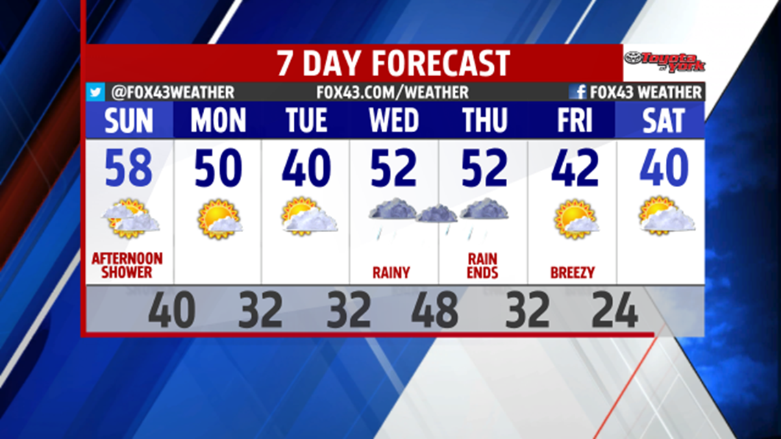
WET MIDWEEK: Look for cloudy skies on Wednesday and Thursday. After a lot of rain on Wednesday, the rain ends on Thursday. We’ll have breezy weather both day, and the winds finally wrap up Friday night. As for Friday–day, we’ll have partly sunny skies and colder weather. We go from 50s on Wednesday and Thursday to 42 on Friday.
-Meteorologist Drew Anderson