


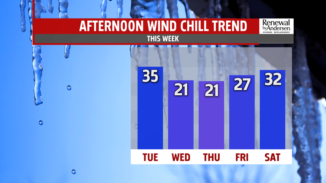
COLD THROUGH MIDWEEK: An arctic air mass arrives for Wednesday, making for a gusty and cold one! Skies turn partly sunny as the arctic front crosses the state, and it could spark some snow squalls or snow showers for parts of the region. This means some must watch for brief bursts of moderate to heavy snow, with reduced visibility and a quick but light accumulation. Afternoon highs are in the lower to middle 30s. Wind chills could feel like the 20s throughout the afternoon. Thursday looks like the coldest day! Morning temperatures are in the middle to upper teens, with wind chills in the single digits! Temperatures during the afternoon only reach the upper 20s to near 30 degrees. Winds are lighter by the afternoon, but wind chills could still feel like the teens at times. Friday brings plenty of sunshine. It’s not as cold, but temperatures are still below average for this time of year. Expect readings in the lower to middle 30s.
MILDER WEEKEND OUTLOOK: The cold, but quiet stretch continues into the weekend, and temperatures should slowly warm. A weak system crosses the region Saturday, kicking up the breezes. It’s closer to seasonal averages for this time of year, with highs in the middle 30s to near 40 degrees. Sunday brings plenty of sunshine. Temperatures are higher, with readings in the middle to upper 40s. Monday is even milder with plenty of sunshine! Temperatures are in the middle 40s to near 50 degrees.
Stay Weather Smart with FOX43! Have a wonderful Tuesday!
-Andrea Michaels