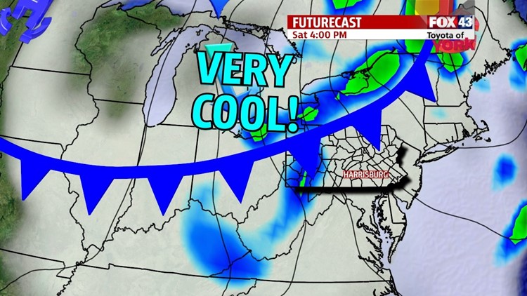

COOLING BEGINS

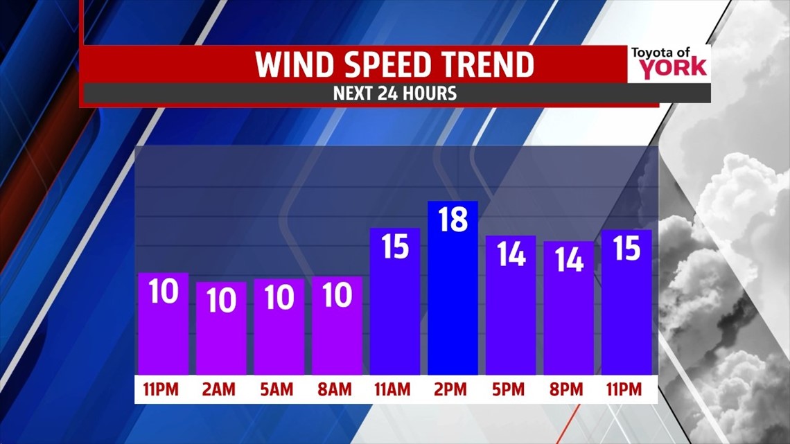
After a mild, fall day, a crisp but quiet evening is expected along the Lower Susquehanna Valley. Clouds break a bit at first, but a cool pool of air to the north spirals in periods of clouds through the night. Lows fall into the upper 40s to middle 50s. A cold front ahead of the cool pool of air begins to dive down Saturday. This brings plenty of clouds through the day, and a few late day or evening sprinkles are possible. It is also very breezy. Highs are much cooler, in the upper 50s to lower 60s.
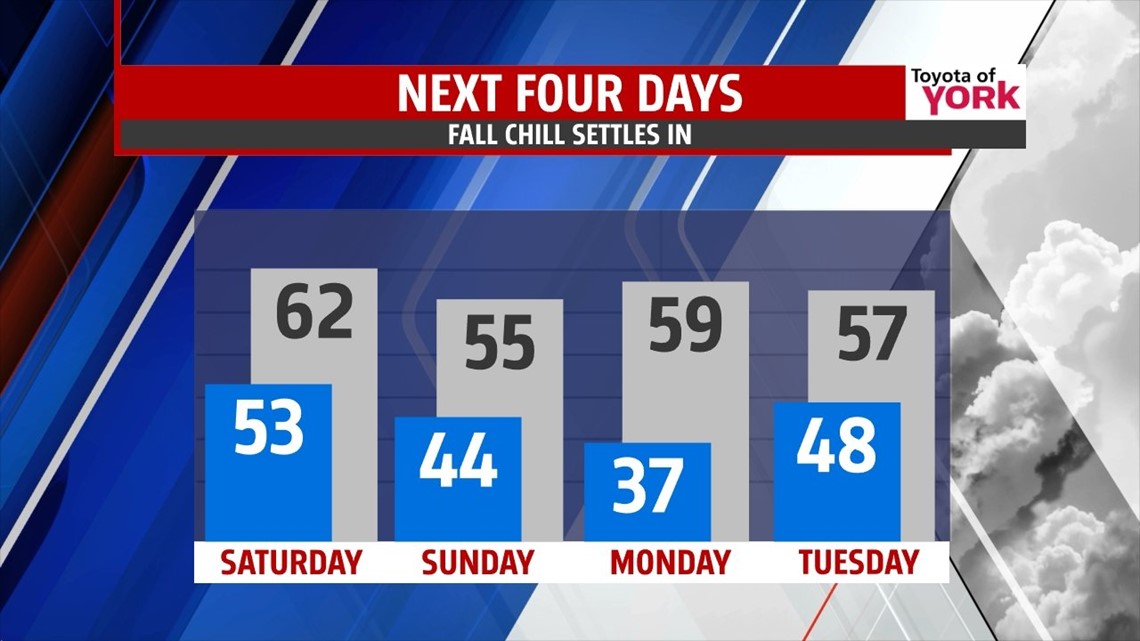
FALL CHILL SETTLES IN
Temperatures fall well below seasonable averages on Sunday as the cool pool of air settles across the area. It’s a partly sunny, breezy, and chilly day with readings in the lower to middle 50s. The pattern remains cool leading into the beginning of next week too. After a cold, frosty start, Monday is dry with building clouds. Highs rebound a bit to near 60 degrees.
SHOWER CHANCES RETURN
Our next system arrives Tuesday, bringing mainly cloudy skies and a few showers. The system stalls just off the Atlantic coast, keeping the clouds and shower chances around through the middle of the week. Temperatures are stuck below seasonable averages in the lower to middle 50s Wednesday and Thursday. Skies don’t dry out until Friday, and temperatures begin to bounce back near seasonable averages.
Have a great weekend!
-Andrea Michaels