
HARRISBURG, Pa. — Though nearly a month away, hurricane season is starting to take center stage in the minds of meteorologists, hydrologists and more as National Hurricane Preparedness week continues.
“Find out what supplies you need, start trying to obtain those supplies. All about being ready by June 1st," Daniel Brown, Senior Hurricane Specialist and Warning Coordination Meteorologist with the National Hurricane Center in Miami, Florida, said.
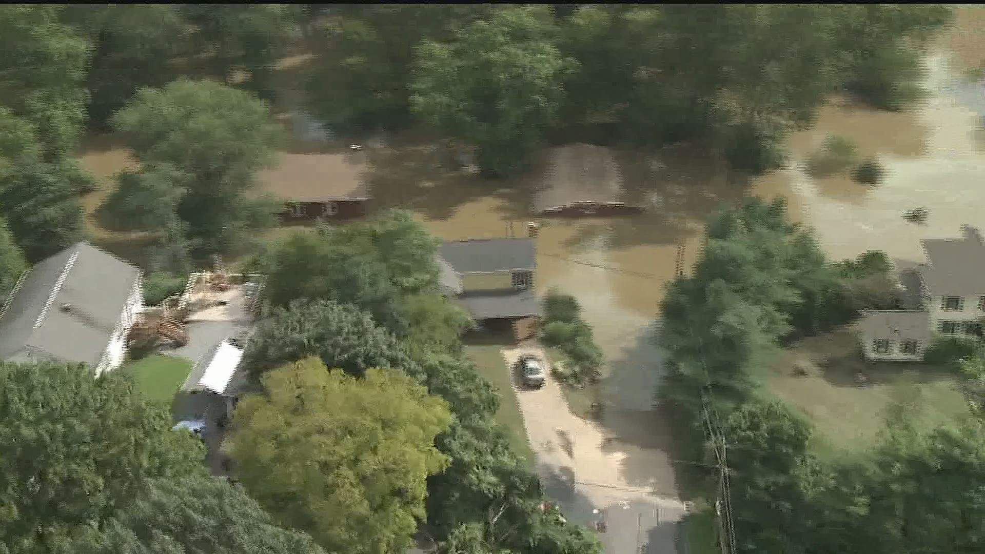
South Central Pennsylvania is not exactly a hot spot for hurricanes, but the area is no stranger to seeing rain and wind from weakening hurricanes and tropical storms. Most minds who've lived in the region awhile think back to tropical storms Lee and Agnes, which caused devastating flooding.
The reality, flooding, especially in tropical storms, tends to be where the killing is. Most of the deaths from tropical storms is due to water, whether storm surge or inland flooding," Robert Shedd, Service Coordination Hydrologist with the Mid-Atlantic River Forecast Center in State College said.
The National Hurricane Center won't come out with their official season forecast for several more weeks. However, another reliable source came out with their guidance in April.

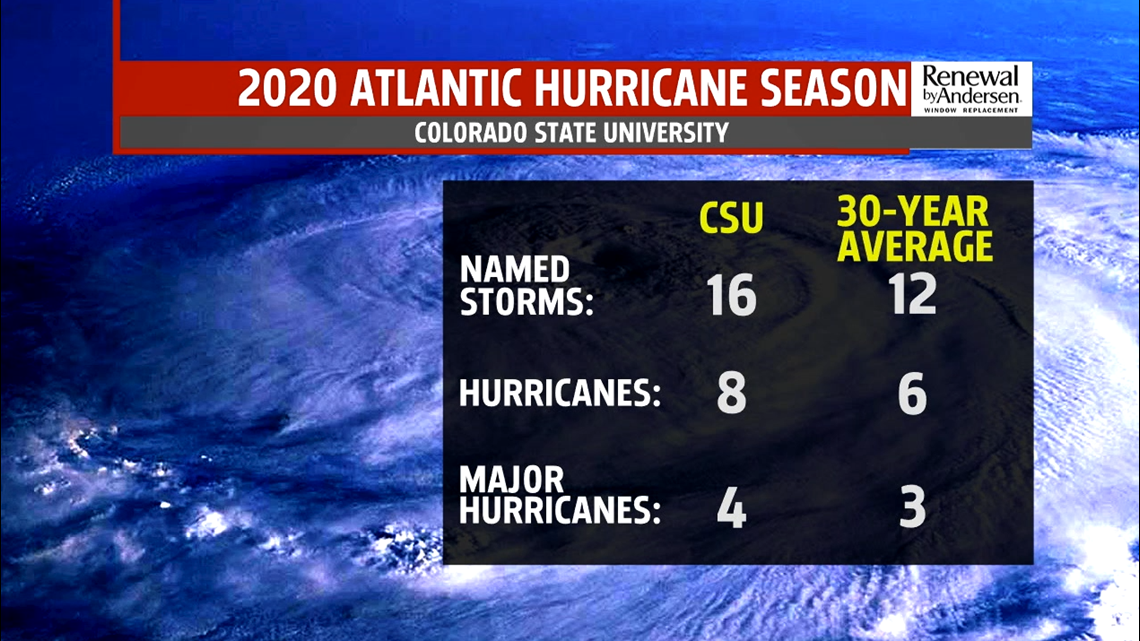
Scientists at Colorado State University predicted 16 named storms for the 2020 hurricane season, which is above average. They predict eight will reach hurricane status, with four becoming major hurricanes.
But just because an above average season is predicted, does not mean that it will be more impacting on the United States. This forecast is simply for the number of storms, not where and when they will occur. Hurricane Andrew, one of the most devastating hurricanes in history, happened during a relatively inactive season back in 1992.
“We’ve had years like 2010, where we have a lot of hurricanes but not a lot of US impacts," Brown said. "We really have to see how these storms form, where they’re going to go. That’s what a seasonal forecast can’t tell you."
The prediction of a more active season falls on a variety of reasons, but primarily due to a lack of predicted El Nino in the summer months, leading to a predicted La Nina towards September.


Breaking it down, it means this: cooler than average sea surface temperatures along the Equator in the Pacific Ocean (La Nina) leads to a variety of things. For the sake of this discussion, it usually leads to less wind shear over in the Atlantic Ocean, which allows stronger storms to form easier in the Atlantic.


Warmer than average waters, earlier in the season, along the Gulf and Atlantic coasts also allows for more energy once storms move into the area.
Until then, it's business as usual in our area. Stay tuned to the latest information from the FOX43 Weather Team. We'll give you the information you need to be Weather Smart.