
Large numbers of migrants continue to cross the southern U.S. border without legal authorization. Recently, a meme went viral on social media claiming migrants are provided maps to help them get to the southern U.S. border by the Red Cross.
“Red Cross is providing maps on how to travel to the border,” the meme says. “Here’s something to think about when you donate to the Red Cross.”

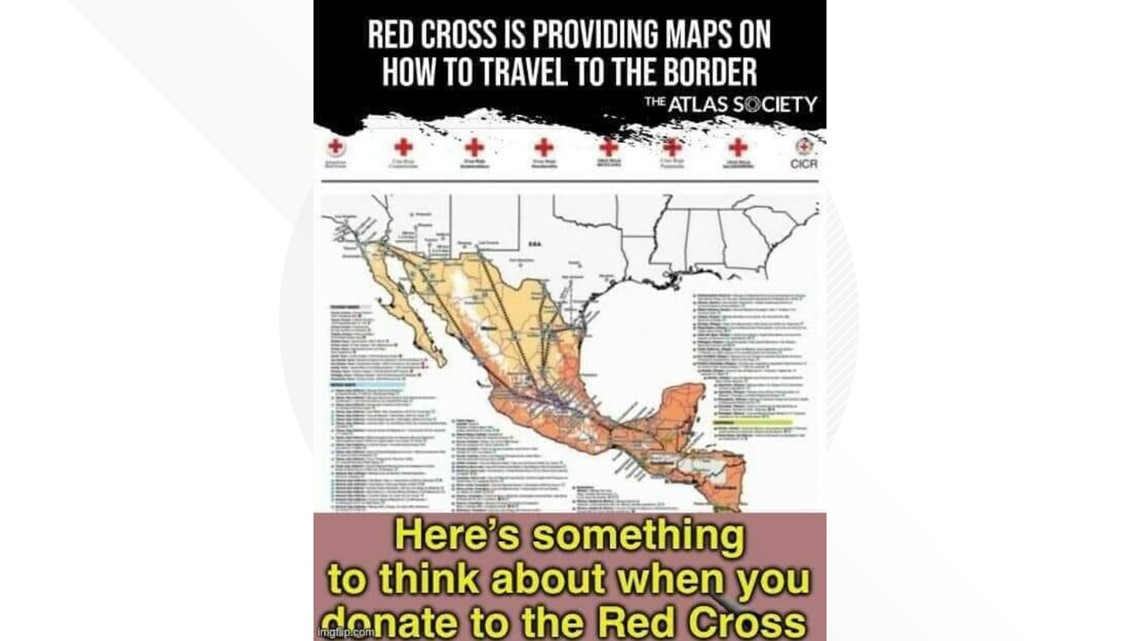
“The American Red Cross is under fire for reportedly providing migrants with maps and guides to help them make the dangerous journey through Mexico to the U.S. border,” one Facebook post with the meme says. A Fox News report also says that the Red Cross is providing migrants with maps.
Several VERIFY readers, including Joe, reached out to ask if that’s true.
THE QUESTION
Has the Red Cross provided maps to migrants traveling towards the U.S. border?
THE SOURCES
- American Red Cross
- International Committee of the Red Cross
- RevEye, a reverse image search tool
THE ANSWER
Yes, the Red Cross has provided maps to migrants traveling towards the U.S. border
WHAT WE FOUND
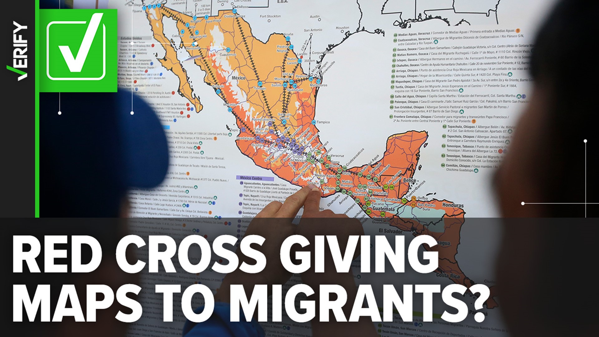
The map in the social media meme is real. Different versions have existed since at least 2018 and some have been distributed by the International Committee of the Red Cross (ICRC). The ICRC is a consortium of Red Cross agencies, including the American Red Cross.
The map is part of an informational safety pamphlet provided by aid organizations, including national Red Cross societies, to migrants traveling in Central America. The pamphlet also includes resource information like where to find food, shelter and medical assistance.
While the map has been around since at least 2018, the American Red Cross partnered with the Mexican Red Cross and others during the COVID-19 pandemic to promote these safety materials. The Red Cross logos appeared across the top of the map. The American Red Cross logo was removed in 2022 after the COVID-19 partnership expired.
The current pamphlet containing the map shows the current partners are the National Red Cross Societies of Mexico, Guatemala, Honduras and El Salvador.
“This document, like the humanitarian action of the International Red Cross and Red Crescent Movement, does not seek to encourage or discourage migration, but rather to contribute to mitigating the vulnerability factors of this population along the migratory route,” the ICRC says.
The pamphlet provides not only a map of Central America and Mexico, it also provides the following information:
- Locations of shelters
- Locations of free services including food, medical assistance and places to make free phone calls
- Climate information
- Train routes
- Water crossings
The travel guide is not new. VERIFY also found an article from PBS NewsHour published on Oct. 22, 2018, that includes a photo of the map taken by a Reuters photographer.
Another photo of a similar map with a legend offering information to migrants was also published by the Associated Press in 2018.