

HIT OR MISS SHOWERS
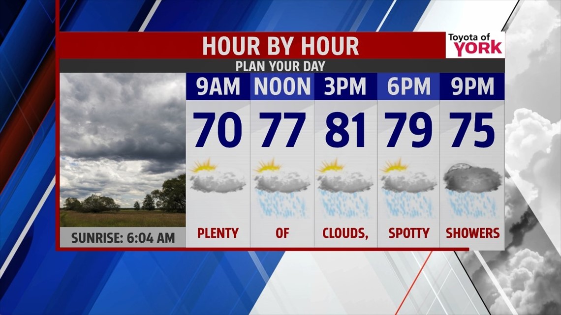
We begin the month of August unseasonably cool and with some showers across the Lower Susquehanna Valley. An upper level area of low pressure begins to retreat into Canada today. This would be good news, but a blocked flow in the Atlantic helps a stationary front slowly retrograde west. This means clouds quickly thicken through the morning hours. There are some foggy spots as well, with a passing shower or two. By the afternoon, many of us will be dodging showers, perhaps a thunderstorm, but the day isn’t a washout. The humidity increases a little as well. Highs are near 80 degrees.
UNSETTLED WEEKEND

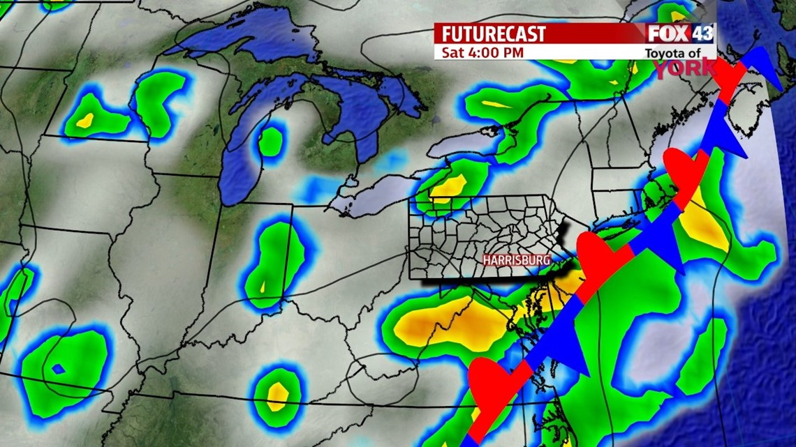
The front continues to drift inland over the weekend. Saturday, plenty of clouds continue to hang across the region. The shower and thunderstorm chance remains as well, and for some locations, it could be a pretty damp day. Highs are in the middle to upper 70s. Sunday brings a better chance for showers and thunderstorms, with highs in the upper 70s to lower 80s.
BACK TO AVERAGES
Monday another cold front swings down from the northwest, and this dissolves the stalled front. We have an isolated shower and thunderstorm chance Monday, but temperatures warm back average. Tuesday brings drier conditions, but Wednesday and Thursday look unsettled. Highs remain in the middle 80s.
Have a great weekend!
-Andrea Michaels