
SEVERE THUNDERSTORM WATCH until 11pm tonight.
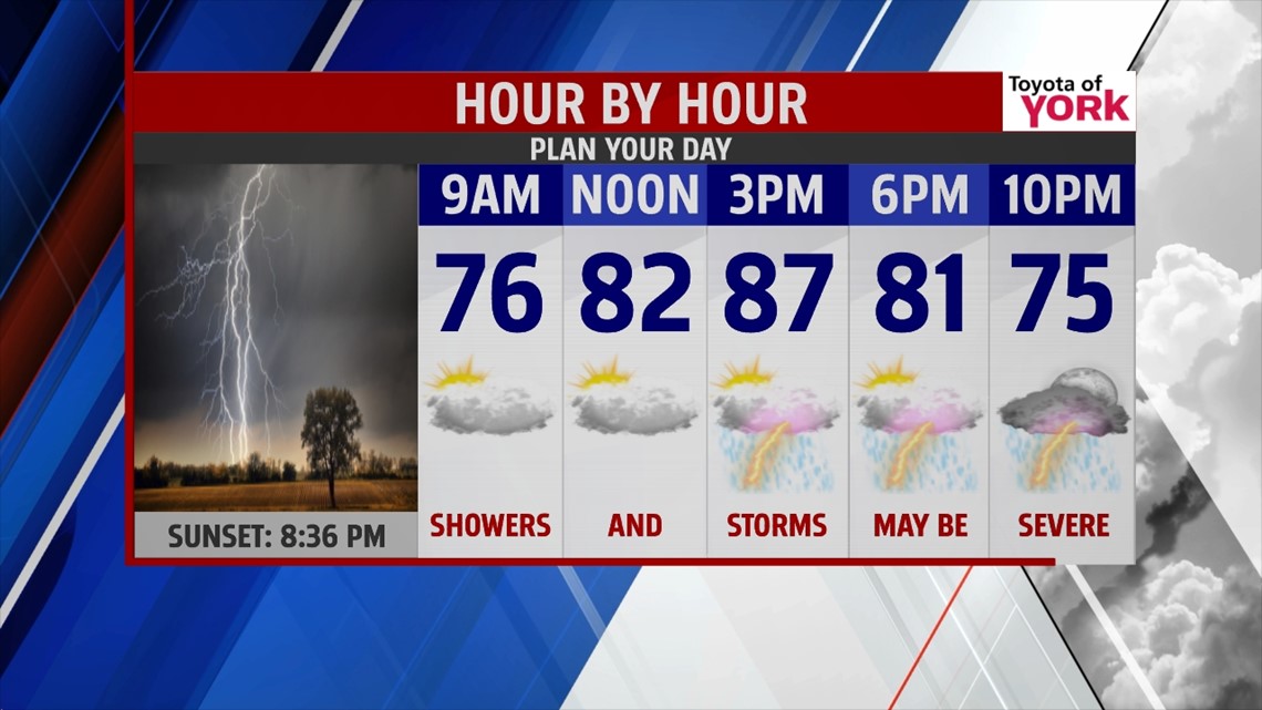
THIS EVENING: Showers and storms ahead of a frontal boundary are pushing in from the west. They will move in this evening and spread east. Main threat will be damaging winds and very heavy downpours. Tornado threat is low and should remain just outside our area. Hail threat is low. It is very warm with the temps in the mid to upper 80s. They are expected to drop into the 70s.

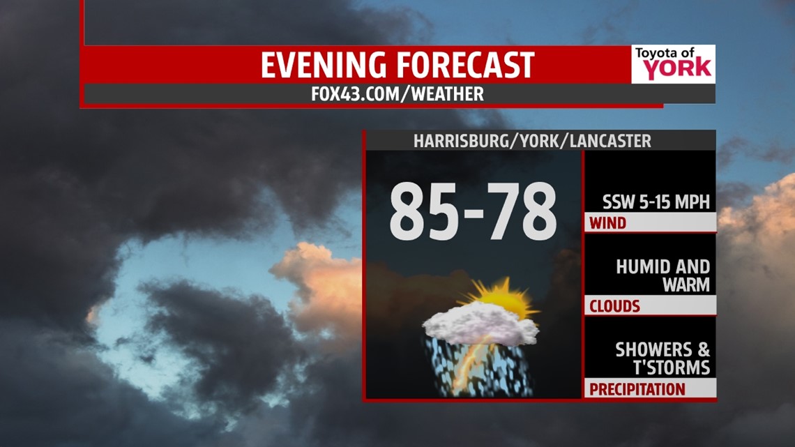
OVERNIGHT: Few showers may linger until around midnight, otherwise, mostly cloudy, muggy with patchy fog and lows around the low 70s.
TOMORROW: Next boundary arrives and brings yet another threat for severe weather. There could be a few showers and storms early in the day but the best chance will be in the afternoon and evening. This is when we expect severe storms. STORM PREDICTION CENTER has most of our area in a SLIGHT RISK for severe storms.

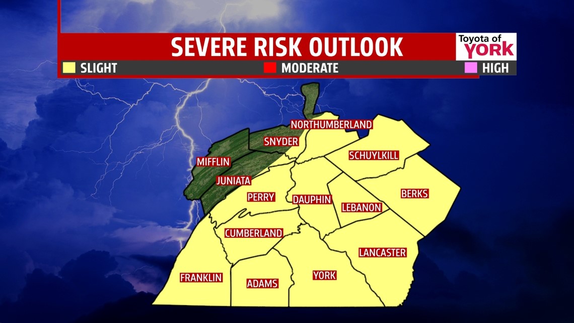
Main threats will be damaging winds, small tornado threat, hail threat and heavy rainfall which may cause minor flooding. Highs will be warm in the mid 80s.

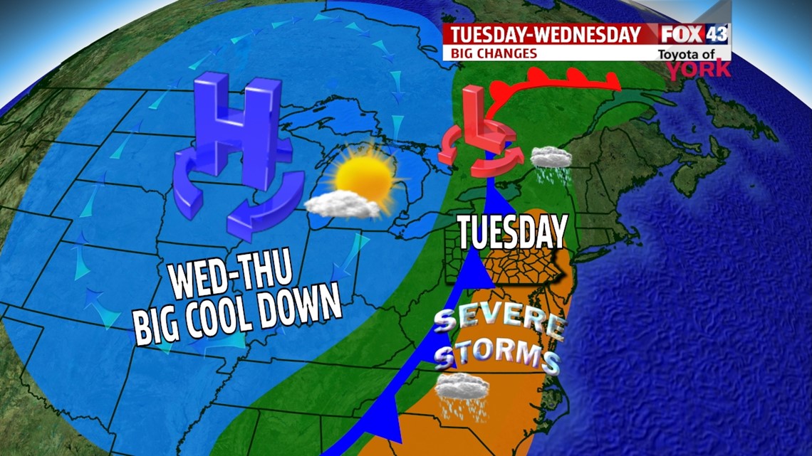
OUTLOOK: A cold front arrives early Tuesday triggering showers and storms early but right now it looks like the severe threat will be to our south. Highs will warm to the mid 80s but much cooler air will push in by Wednesday as a deepening trough spills below average cool air south into the Ohio Valley. Highs Wednesday may not even get out of the 70s and the very unseasonable like temperatures will continue through Friday. This is supposed to be the hottest time of the year but we will get a nice refreshing stretch of cool air. Isolated storms will move for the weekend.

MaryEllen Pann, Chief Meteorologist
Like me on Facebook: maryellenpannfox43
Follow me on Twitter: @MaryEllenFox43