

TURN THE HEAT BACK ON!

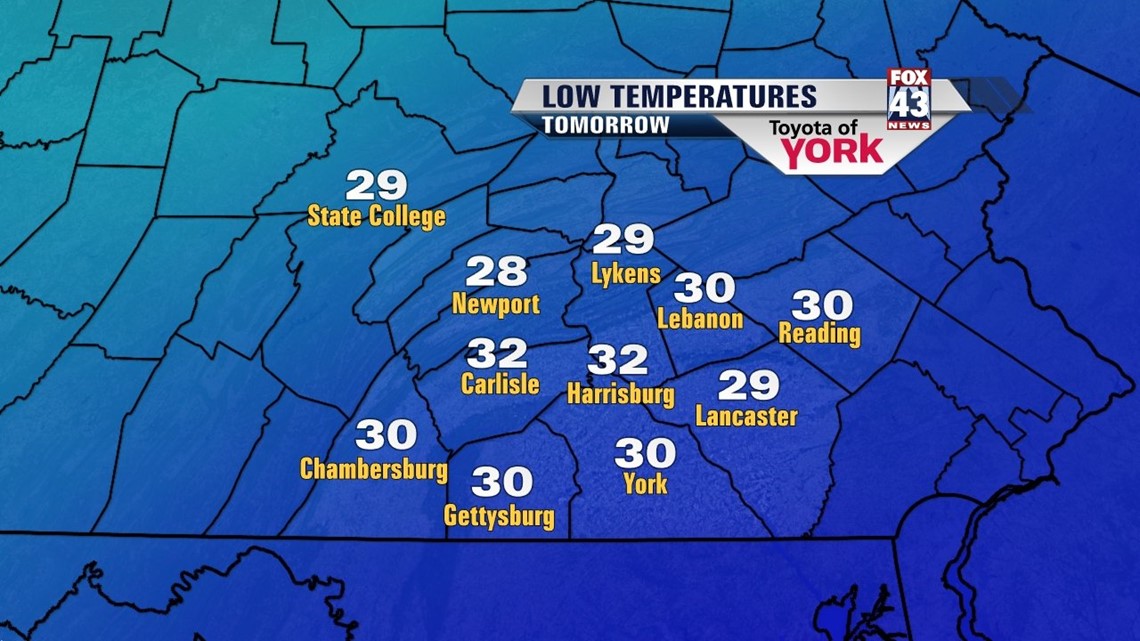
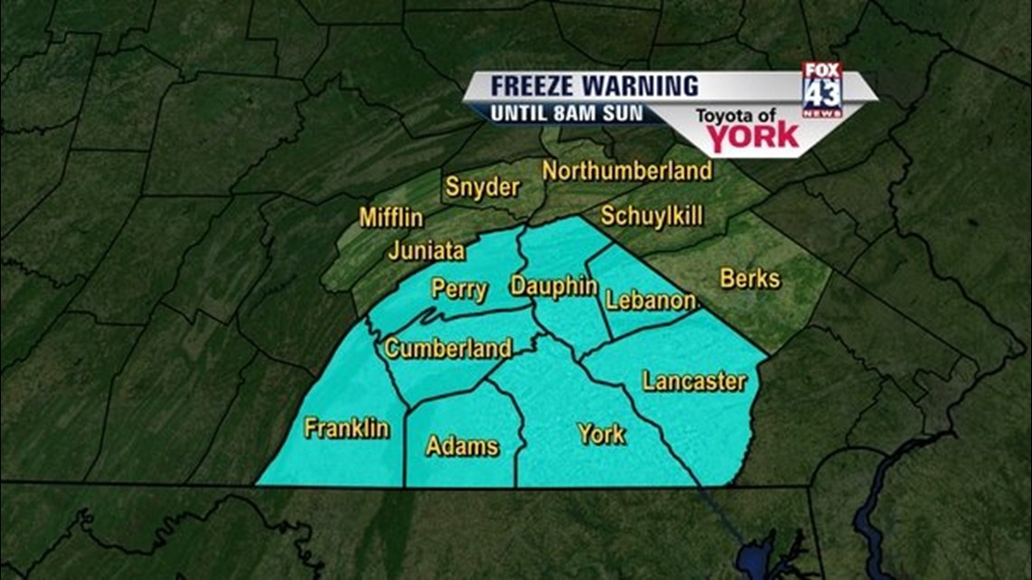
A Canadian area of high pressure positions itself just to our north through the overnight period, leading to one of the coldest nights so far this April. With light northerly winds and clear skies, expect temperatures to quickly drop this evening. Lows in the upper 20s to lower 30s means patchy areas of frost are likely, so be sure to cover tender vegetation and bring in potted plants. A Freeze Watch is in effect as of the afternoon hours, but it will likely be upgraded due to the frigid conditions expected.
UNSEASONABLY COOL THROUGH THE WEEKEND
Sunday’s frosty start is a sign of what to expect the rest of the weekend. High pressure slips of to our northeast, leaving it in a position to keep the chilly air locked in place. Temperatures are still unseasonably cool in the lower to middle 50s. Some places to the northwest could get stuck in the upper 40s. Otherwise, there at least is plenty of sunshine. Perfect afternoon running weather!
CALM WEEK AHEAD
The new work week is characterized by overall quiet conditions, with temperatures at or just a little below average. Skies are mostly clear Monday with high pressure still in control of the weather. After another frigid start, highs climb to near 60 degrees. A system moving north along the coast brings some clouds Tuesday, but it’s mainly dry with some sunshine expected as well. Our next cold front moves through Wednesday, bringing some rain. We’re dry again with sunshine Thursday and Friday with highs in the lower to middle 60s. Clouds build back Saturday, with a shower possible.
Enjoy the rest of your weekend!
-Andrea Michaels