
Showers will continue through the evening before ending as a cold front pushes east. Temperatures are still mild in the 60s but will fall rapidly behind the front into the 40s overnight. Skies will clear quickly as high pressure builds in. Winds will pick up out of the west 10-15 mph.
SUNNY END TO THE WEEK
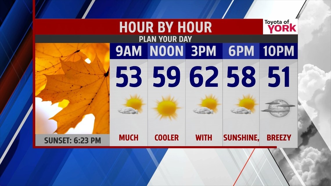
High pressure builds in behind the departed front tomorrow. Morning lows will be noticeably cooler in the upper 40s to around 50 and afternoon temperatures will be closer to average in the low 60s. Winds will be a bit gusty out of the west 10-15 mph with gust to 25 possible.

WEEKEND OUTLOOK
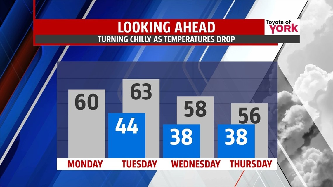
Over the upcoming weekend, a broad trough will settle over the east. Numerous disturbances will rotate through assisting cold front through the area Saturday night and again Tuesday. There is a small shower threat late in the day Saturday but rain should scoot out of the area after midnight. Highs will be seasonal in the mid 60s to start the weekend but overnight lows will dip into the low 40s Sunday and only warm to around 59 by the afternoon under partly cloudy skies.
COLDER START TO WEEK
Monday many areas will dip into the 30s! Plenty of sunshine with temperatures warming to around 60. Tuesday will be milder as the next front arrives. It looks moisture starved at this point but will drive in even colder temperatures for Wednesday and Thursday as overnight lows dip into the 30s and highs in the mid 50s.

The feel of fall will return next week!
MaryEllen Pann, Chief Meteorologist
Like me on Facebook: maryellenpannfox43
Follow me on Twitter: @MaryEllenFox43