

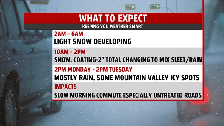
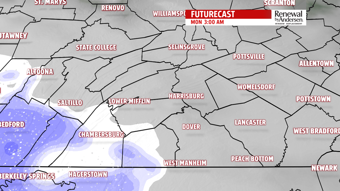
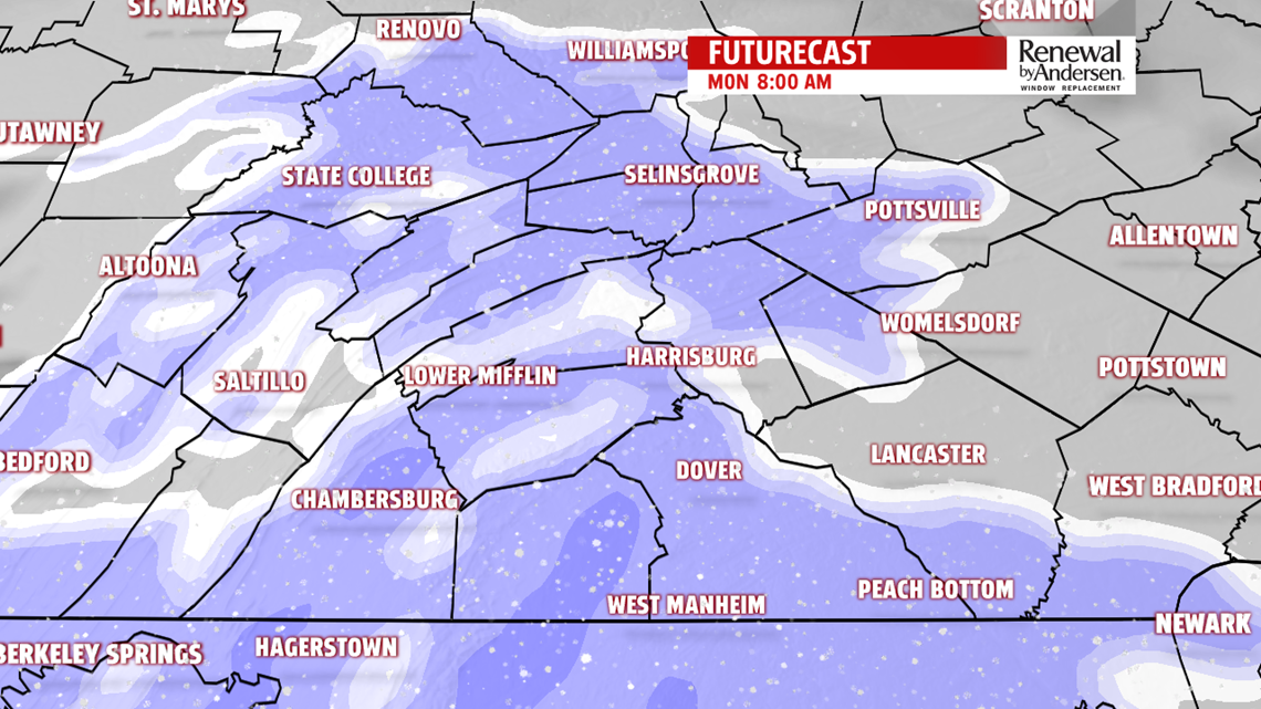
The scattered clouds and the blustery winds from Sunday are thinning out and calming down just in time for another soggy storm system to affect us for the first two days of the new workweek. However, this event will start off the day early Monday with some accumulating snow that will slow down the commute. Accumulations look to range from a coating to as much as 2″, with just about all locations in our area with the same potential for either end of that range. A few isolated areas of slightly higher amounts may occur in the higher elevations along the I-81 corridor, and also between the Mason-Dixon line and Baltimore.Most of the accumulations will be on grassy areas, but untreated roads would see some “stickage”, also. Treated main roadways will be mainly wet.
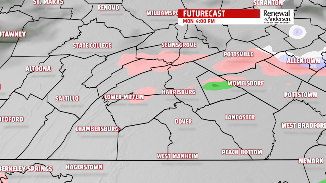
The atmosphere will not be cold enough nor dry enough for this to be a prolonged snowstorm; in fact, warmer air aloft during the day Monday will change us over to sleet and freezing rain before eventually warmer air at the surface wins out, changing us over to plain rain. That will be a slow, gradual process during the day into the afternoon and evening. The normally colder valleys in the mountains will hold onto the colder air at the surface longer, keeping some of the icy precipitation going a little longer.


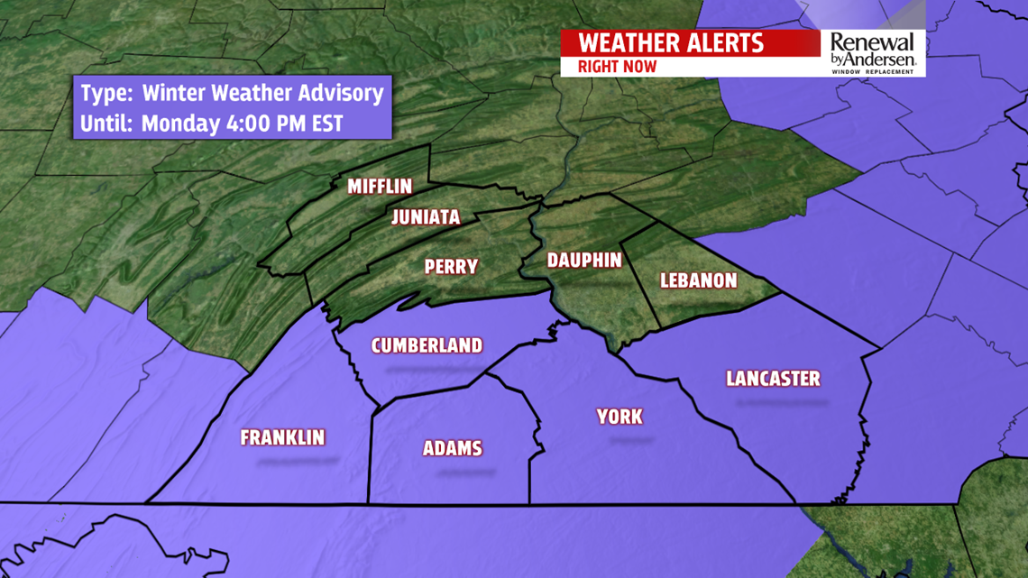
The lower Susquehanna Valley will have a Winter Weather Advisory starting at 2am Monday and lasting until 4pm Monday because of the nuisance impacts of the winter weather. The upper counties are not included because the thresholds for bulletins are higher in those areas, even though the impacts will be the same as the southern counties.

The storm system will move up to our northeast on Tuesday, ending the rain and bringing temperatures up into the low 40s, especially if there are peeks of sunshine. But regardless, cold air will rush in on blustery winds Tuesday night. The next several days after that all the way into the weekend look to be dominated by Arctic high pressure, keeping the weather pretty quiet for us but cold and dry with temperatures well below average, especially during the nighttimes.
