

After a couple of wet days that started on Friday, the storm system that kept the rain going into Saturday is heading out to sea and dragging a cold front through the area Saturday night. Winds will pick up during the nighttime hours making it feel chilly, but the winds will be drying us out nicely, minimizing the threat of any refreeze. Also, temperatures will stay just above the freezing point. The blustery conditions will last throughout most of Sunday before the winds finally settle down Sunday evening.
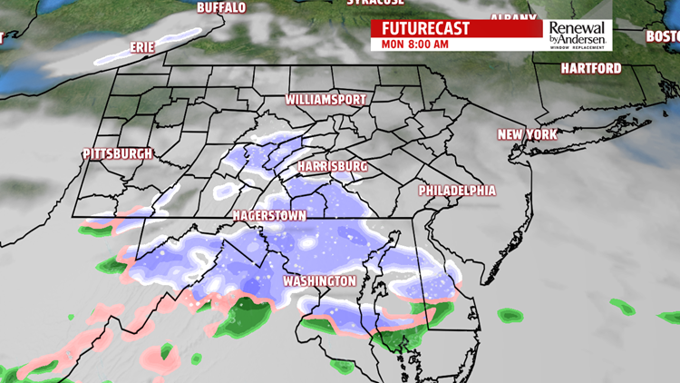
The front will park itself just to our south as another wave of low pressure develops along it in the Plains states, tapping moisture from the Gulf of Mexico, and sending it quickly back our way. Clouds will already be overspreading the area Sunday night, and a swath of precipitation will develop very quickly from southwest to northeast. This will be a band of snow arriving in time for the Monday morning commute. At this time, it’s believed that most of the impact from this band will be to our south in Maryland and close to Washington, with only light snow and minor accumulations for us before the bands break up during the midday hours on Monday. Any slight fluctuation in where the bands ultimately form may mean slightly higher accumulations for us, so it will be something for us to track all Sunday night. But either way, the warmer air associated with the flow of moisture coming up from the South will take over and any snow will mix with sleet and rain and then change over to plain rain. That rain will last into Tuesday, also.

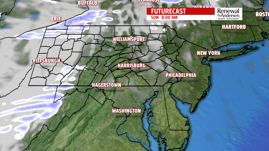
(The Weather Company’s RPM computer model is shown in these Futurecast images. Mainly clear skies on Sunday morning will quickly give way to more clouds by the end of the day. Light snow is likely first thing Monday morning before a wintry mix and rain take over.)
Tracking this system will be the busiest we’ll be all week. A sprawling area of high pressure will start building in Tuesday night and make the rest of the workweek dry and fairly quiet, albeit it fairly cold, especially during the nights.
