

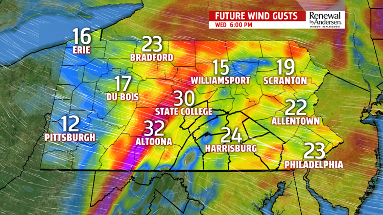


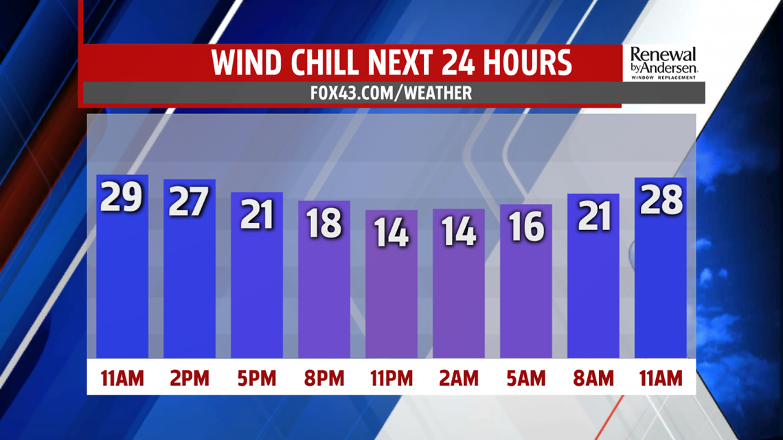
WIND CALMS DOWN: Breezes gust upwards of 30MPH for the rest of the day. Snow squalls will remain a concern for the day as well. Otherwise, lake effect flurries will also be possible under partly cloudy skies. Temperatures reach the mid-30s for high temperatures. As the winds die down overnight tonight, temperatures tumble into the teens for morning lows with mostly clear skies. Thursday is cold, but dry and with only a light occasional breeze. High temperatures reach the low-to-mid 30s.
WARMING, RAIN CHANCES: After a morning start in the upper-20s, Friday temperatures warm significantly. Highs near 50-degrees with increasing cloud cover throughout the day. Late showers move through with our next storm system that is providing the warmer temperatures. Saturday morning starts in the mid-40s with high temperatures in the low-60s. Off-on showers will be the norm all day Saturday and into Sunday morning. Temperatures are warmest early Sunday morning, in the mid-50s. We drop all day long after that with clearing skies.
HEADING INTO NEXT WEEK: A bit of a breeze returns Monday with temperatures in the mid-to-upper 40s. We keep the warmer temperatures into the middle part of next week. We could see the return of a shower or two Monday with a higher chance Tuesday. Stay tuned for updates as we get closer to time.
Stay “Weather Smart” with the FOX43 Weather Team all week long!
-Meteorologist Jessica Pash
