

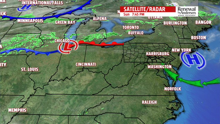

START OF THE WEEK: We keep the dry weather pattern going to start the month of October – at least through Monday. High pressure which provided for such great weekend weather is now offshore and will give way for a slow moving warm front to approach the Ohio Valley and mid-Atlantic. As this occurs, milder southerly flow will bring warmer temperatures for the week. Temperatures across much of the western half of Pennsylvania have already jumped 10 to 12 degrees warmer within a 24 hour period. Expect similar temperature increases across south-central Pennsylvania on Monday as our highs reach into the upper 70s to near 80 in some spots! Normal high temperature for this time of the year should be 70 degrees. Moisture and humidity is also on the increase – clouds should begin to become more numerous though the day Monday and Tuesday.


NEXT RAIN CHANCE: Our next focus is on a system to our west which will bring a cold front across Pennsylvania on Tuesday. It is likely to expect showers and a few strong thunderstorms Tuesday afternoon and evening. Skies are mostly cloudy Tuesday with high temperatures around 78 degrees. Another brief drying period is expected for Wednesday and Thursday with both days in the upper 70s once again. Another wave of moisture moves in from the Midwest which could bring us a few showers Friday morning. High temperature Friday is near 76 degrees.
Enjoy the week and the start of October!
– Meteorologist Alan Petko
