
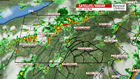

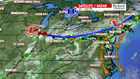
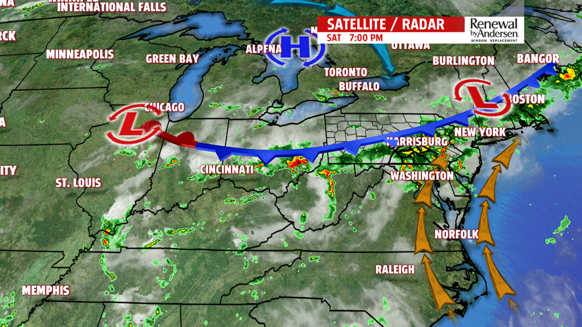
SATURDAY EVENING STORMS: A cold front moving south from Lakes Erie and Ontario toward the mid-Atlantic Coast brought widespread thunderstorms across central Pennsylvania Saturday afternoon and evening. Storms carried locally heavy rain, gusty winds, and a quick 20 degree temperature drop. As it continues to move south and east, this line of showers and storms will weaken overnight and allow some drying by Sunday morning.

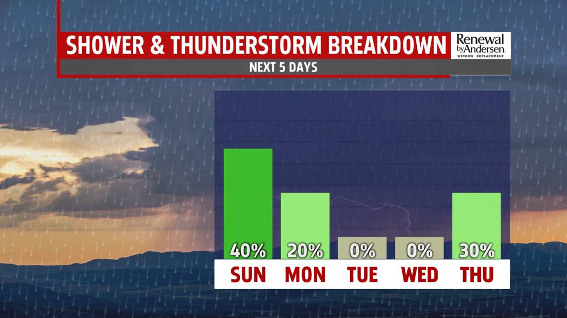
SUNDAY: A few storms can’t be ruled out on Sunday as the front lingers to our south. Highs in the upper 80s – but the humidity will begin to drop later in the day. High pressure begins to bring in drier air for the first half of the week…
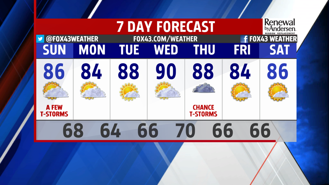
AVERAGE JULY TEMPERATURES: As we head in to the new week, we see temperatures start by moderating to near normal for this time of year (highs in the mid 80s and lows in the mid 60s). We dry out a bit and become more comfortable starting Monday with highs near 84 degrees – expect less humidity and partly cloudy skies. Temperatures bump a few degrees warmer for Tuesday and Wednesday to the upper 80s and nearing the 90 degree mark under mostly sunny skies. The next chance for unsettled weather comes Thursday.
Stay “Weather Smart” with the FOX43 Weather Team all week long!
– Meteorologist Alan Petko
