
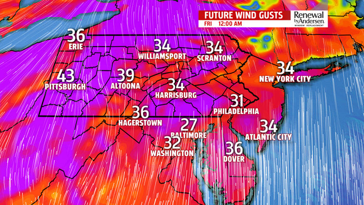


SHOWERS AND WARMTH: Cloud cover continues to spread throughout the evening and overnight time frame. This will keep warm air, combined with increasing southerly winds, in our area. Lows bottom out in the mid-50s as showers begin late Thursday, more into Friday early morning. Light off-and-on rainfall will persist through the morning commute. A few showers could straggle into the Noon hour, but most will be drying out. Overall, the showers won’t be very impactful. Winds persist all day Friday out of the south, gusting to 35MPH at times. Highs near the 70-degree mark in spots will be the norm, so enjoy!
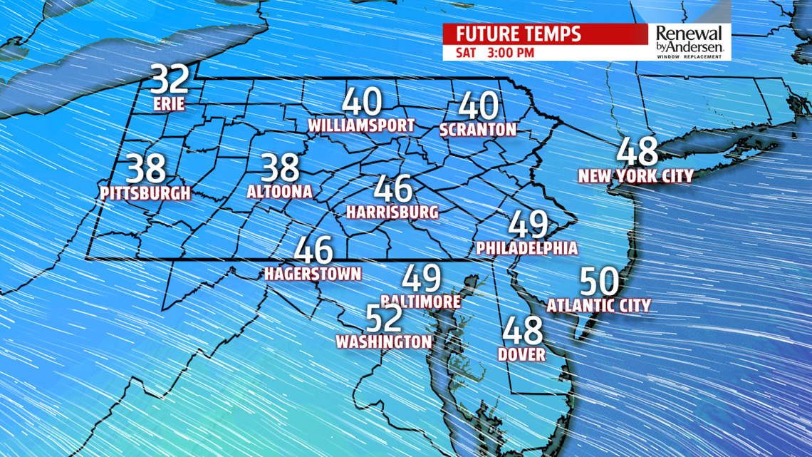
THE WEEKEND: As winds shift to out of the west, then northwest, temperatures rapidly drop. Morning lows Saturday bottom out near 40-degrees, but afternoon highs don’t jump out of the mid-40s with breezy winds continuing. Sunny skies will dominate, however. We dip into the upper-20s Sunday morning to start St. Patrick’s Day, with afternoon highs in the low-to-mid 40s to finish the weekend.
HEADING TOWARDS SPRING: We’re slow to warm in the last few days of the Winter season. Dry, partly cloudy skies take hold Monday and Tuesday with highs in the mid-40s and lows in the mid-to-upper 20s and low-30s. We near 50 to kick off Spring by next Wednesday.
Stay “Weather Smart” with the FOX43 Weather Team all week long!
-Chief Meteorologist MaryEllen Pann
