

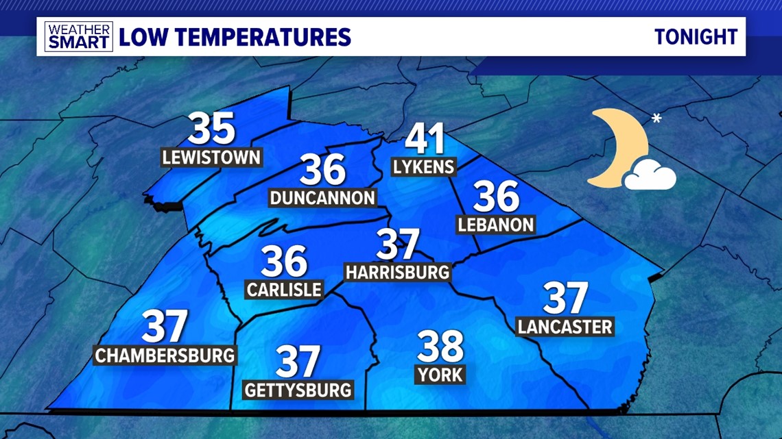
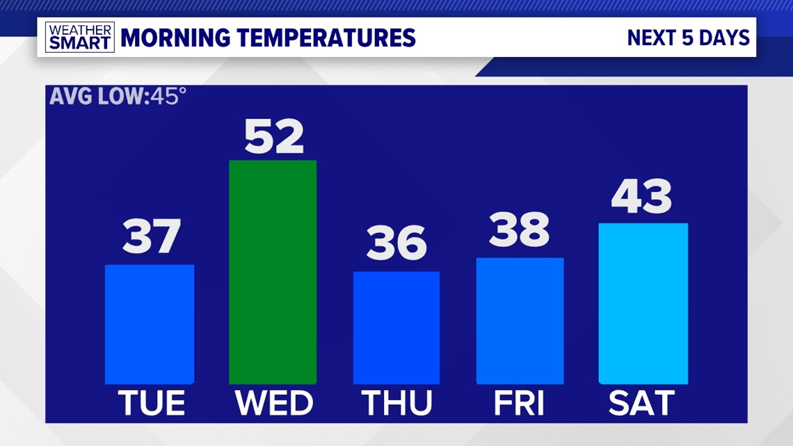
PENNSYLVANIA, USA — ANOTHER FROSTY START: It's another chilly start for our area overnight with a FROST ADVISORY in effect for all of our counties Tuesday morning. Temperatures drop into the mid-30s to near 40 degrees under mostly clear skies.

Some afternoon clouds scoot in for Tuesday. Otherwise, it’s even warmer, with temperatures pushing 70 degrees in many locations. Winds still gust up to 25 miles per hour for many.
MID-WEEK RAIN: Shower chances return before sunrise Wednesday, keeping overnight temperatures a bit warmer as well. We start off in the low-50s with light showers likely.

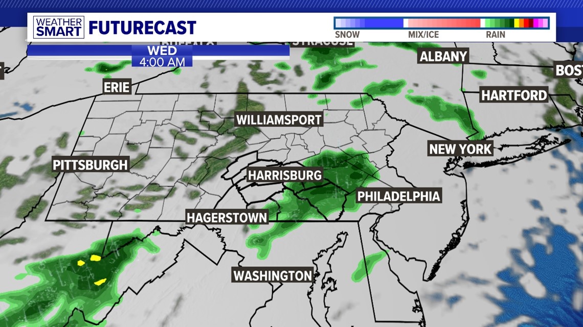
They'll dissipate as we dry out throughout the day, but a few showers could linger into the early afternoon. Stay tuned for updates. Highs reach the mid-60s under otherwise mostly cloudy skies. We dry out with mostly sunny conditions Thursday and Friday, mornings on either side of 40° and highs in the low-to-mid 60s.

WEEKEND SHOWER CHANCE: We'll be ironing out the details on a potential Saturday rain chance with a warm front heading our way into next weekend. Stay tuned for updates, as the current rain chances look sparse but the storm system has yet to develop. You won't need the umbrella too many times this week regardless! Highs look to be on either side of 70° Saturday and into a warmer Sunday.
Stay Weather Smart with the FOX43 Weather Team all week long!
-Chief Meteorologist Bradon Long