
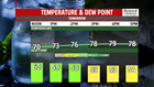


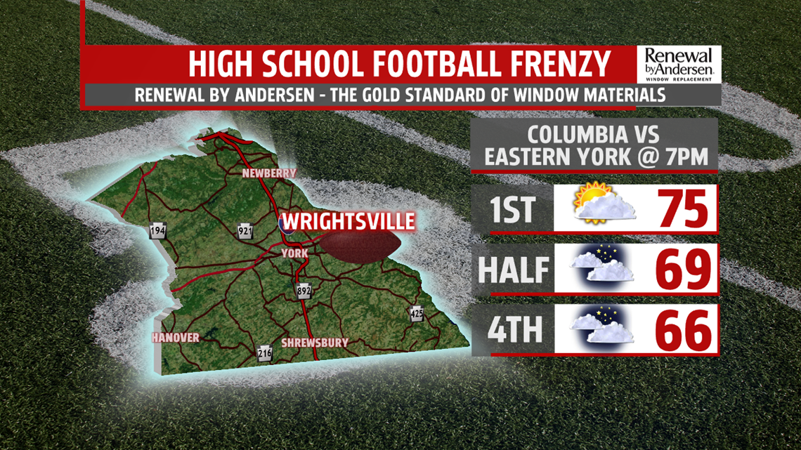
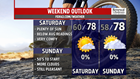
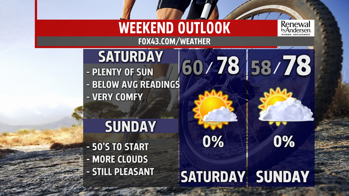
AWESOME CHANGE COMING: We have to get through a few showers and thunderstorms this evening and overnight then the humidity slowly drops heading into Friday. A cold front sweeps through by morning. Lows drop back to the 60s for the first time in several days. A couple of showers are possible early morning in the south, otherwise, we begin the day with partly skies. The breeze kicks in too. Afternoon readings around 80 degrees with many areas in the 70s. It’s a great evening for the first High School Football Frenzy show off. Columbia visits Eastern York with kick off at 7PM. It will feel more like football weather! Heading into the weekend, expect morning lows to drop into the 50s!! Refreshing mornings both days will feel terrific. Highs are near 80 degrees Saturday under plenty of sunshine. More clouds drift in, as an easterly wind sets up Sunday. Temperatures climb to the upper 70s to near 80 degrees.
SLOW WARM UP: We are still below average, in the 70s, Monday. Plenty of clouds hang around too. A stray shower can’t be ruled out but most stay dry. Tuesday, a shift in the winds brings more sunshine and warmer temperatures in the lower 80s. A stray shower or thunderstorm is possible. The thunderstorm chance picks up for Wednesday with our next system crossing the area. The heat and humidity increases too. Temperatures top out in the lower to middle 80s. Thursday is mainly dry and very warm.
Stay Weather Smart with FOX43!
Have a good day!
MaryEllen Pann,
Chief Meteorologist
