


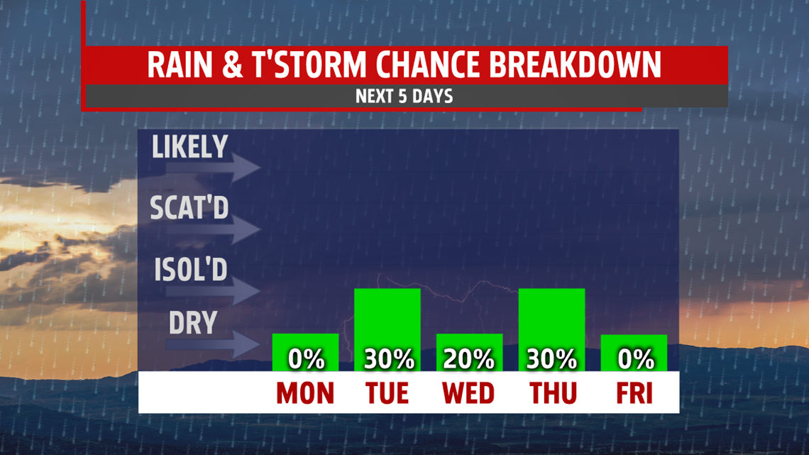

BRIEF WARMING: It’s much drier Wednesday, with more sunshine too. An isolated shower is possible, but most stay dry. Temperatures recover a bit, with readings in the lower to middle 70s. Thursday should see a return to 80s for many, but the next system approaches fast. It increases afternoon clouds, and brings the chance for a few late afternoon or early evening showers. Readings reach the upper 70s to lower 80s.
MORE COOL AIR FOR WEEKEND: Another area of cool, Canadian high pressure settles in for the end of the week and the early half of the weekend. Expect plenty of sunshine for Friday. Only some afternoon clouds pop up and drift through the region. Readings are quite cool, with temperatures in the upper 60s to lower 70s. Abundant sunshine remains for Saturday. Expect slightly higher temperatures, with readings in the lower to middle 70s after quite a chilly start. Sunday is partly sunny, and likely warmer too. We’ll watch for a shower chance to sneak into the forecast, but for now it looks dry. Readings push the 80 degree mark.
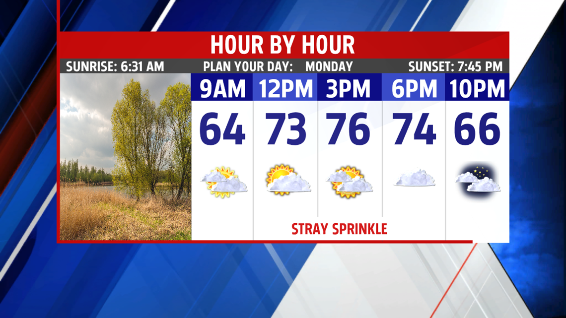
Have a great Monday!
