


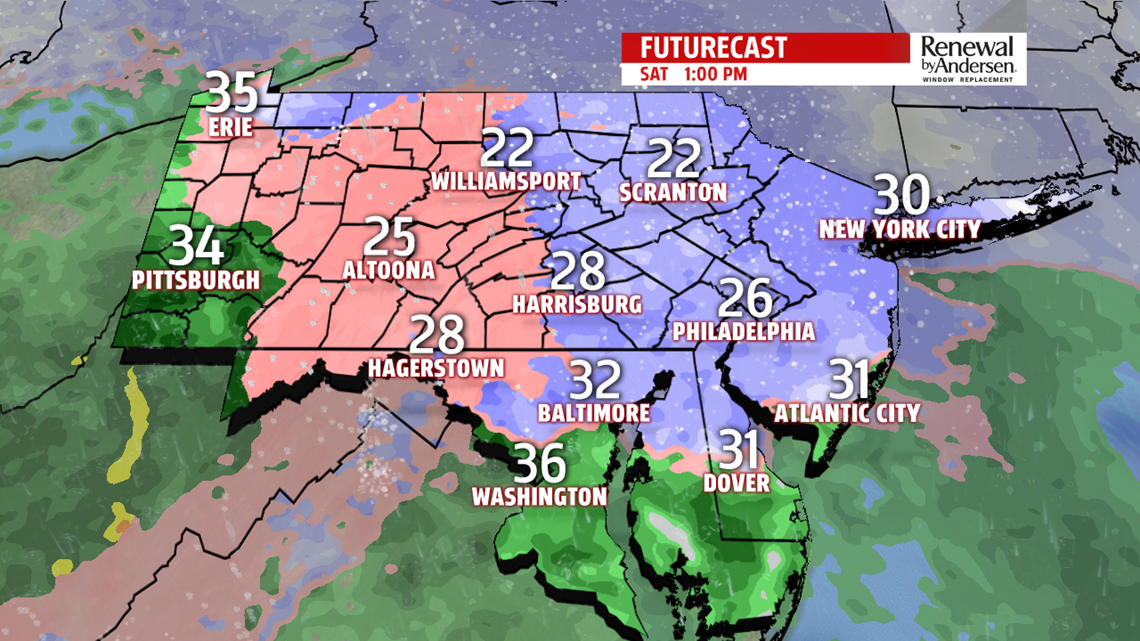

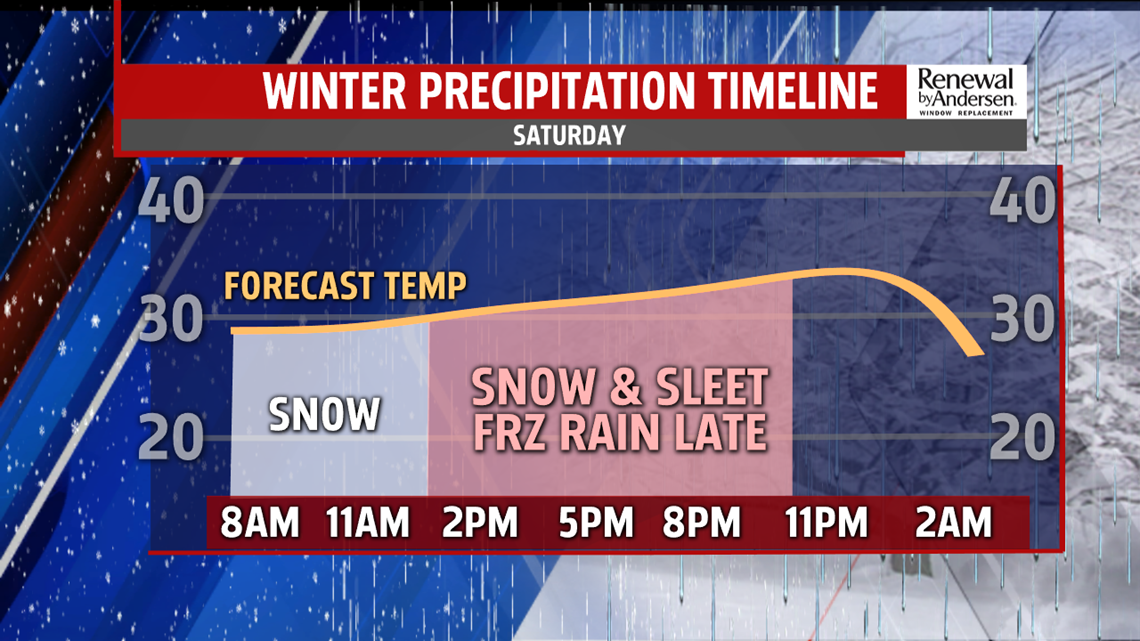
SATURDAY’S STORM: We fall through the 20s this evening with a small wind chill impact. Though, winds do die down as the day progresses. Starting after sunrise, flurries and light snow begin to fall into the morning hours. With an occasional break, snow becomes mostly steady into the late morning and early afternoon. Light accumulation will occur for most spots. Temperature stay below freezing for most of the day. However, we expect warmer air to move into the upper levels of the atmosphere in the early afternoon. This allows snow to melt higher up, but temperatures stay below freezing at the surface. As a result, from the early afternoon through the evening, sleet and freezing rain will be likely for most of the area. The accumulation of the ice, with the snow, will likely cause travel problems, especially as you travel further north. However, even our southern counties can expect plenty of slick spots. A brief transition over to light rain and drizzle is possible as temperatures hold near freezing for most of the day, but rise above after the sun sets through the midnight hour.

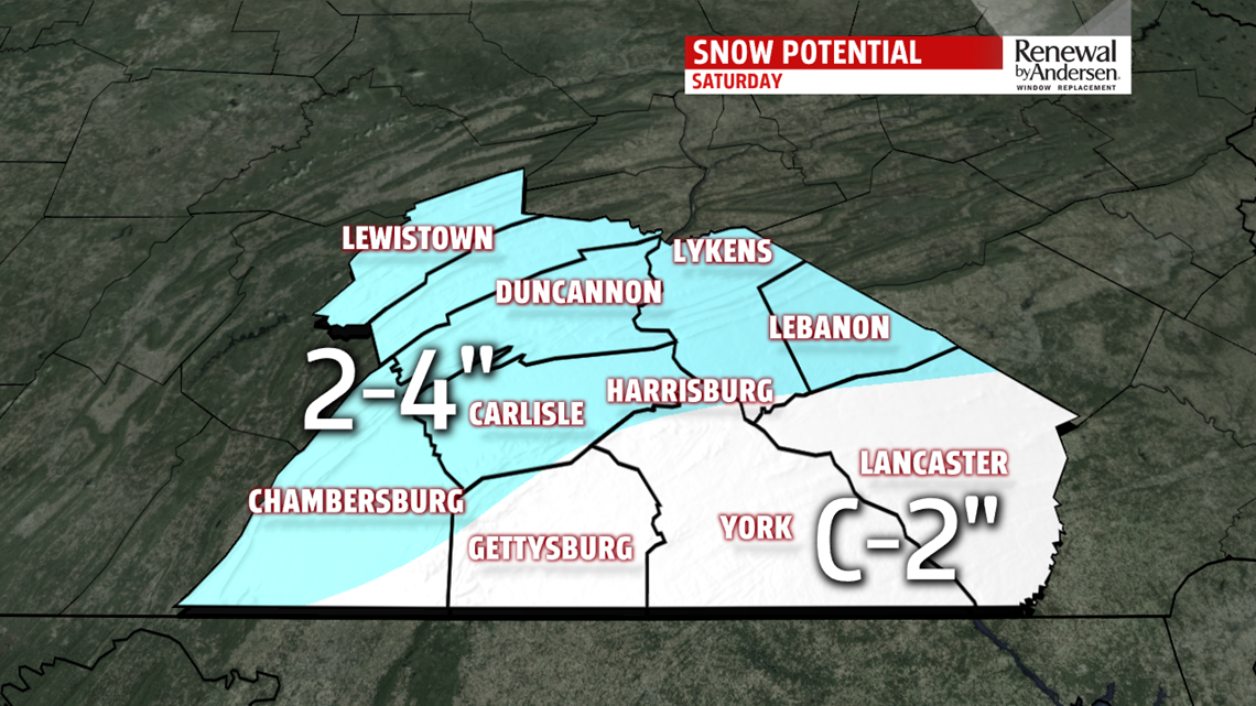

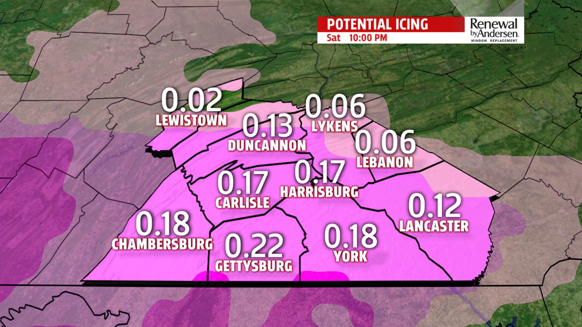
OVERALL TOTALS: 2-4″ north of the PA-Turnpike and west of I-81 will be the norm for snow accumulation. This includes Lebanon, Harrisburg, Carlisle, Duncannon, Chambersburg and areas to the north. C-2″ will be the norm for most of Adams, Lancaster and York counties. However, additional ice accumulations between one-tenth and one-quarter of an inch will pile on top of that, causing plenty of slushy problems area-wide. Stay tuned for updates to these snow and ice totals as we get closer to time.

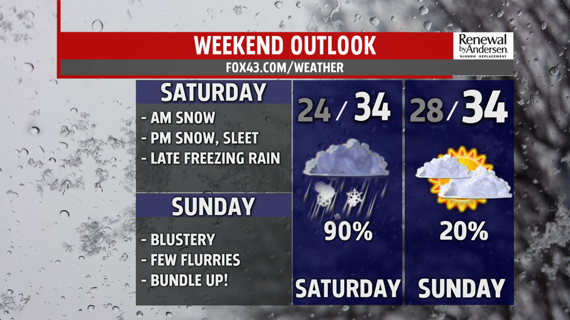

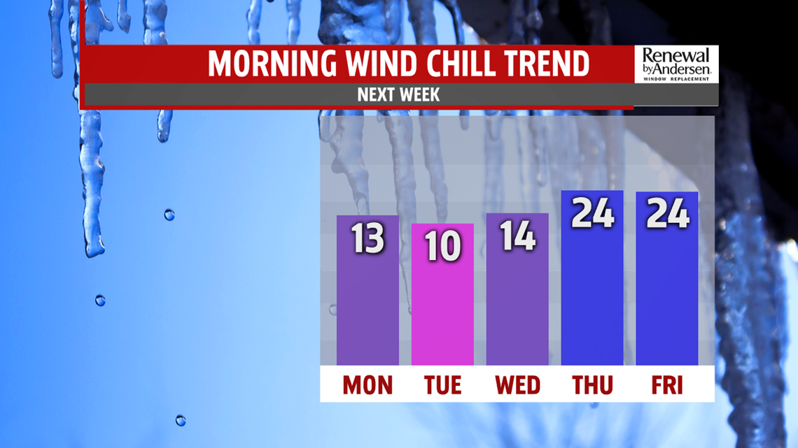
HEADING INTO NEXT WEEK: We keep the cold air heading into next week. Breezy, blustery conditions persist Sunday, Monday and Tuesday with flurries possible each day. High temperatures drop from the mid-30s Sunday, to on either side of 30-degrees Monday and into the 20s Tuesday all with mostly cloudy skies. Morning lows dip into the teens starting Monday with morning wind chills near zero Monday and Tuesday. Bundle up and get ready for cold air all week long!
Don’t forget to download the FOX43 Weather App for the latest Winter weather alerts and custom forecasts to your location! Stay “Weather Smart” with the FOX43 Weather Team all week long.
-Chief Meteorologist MaryEllen Pann
