

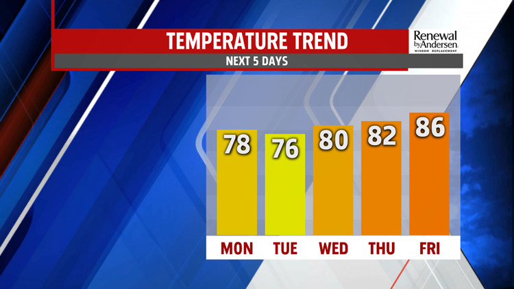

NICE WORK WEEK START: After a cool morning where a few places dipped into the upper-40s, we recover nicely be the afternoon. Highs reach the mid-to-upper 70s area-wide under partly-to-mostly sunny skies. We stay dry with slowly rising humidity by the later portion of the evening and into the overnight. Clouds increase overnight into Tuesday morning with lows in the upper-50s and low-60s.

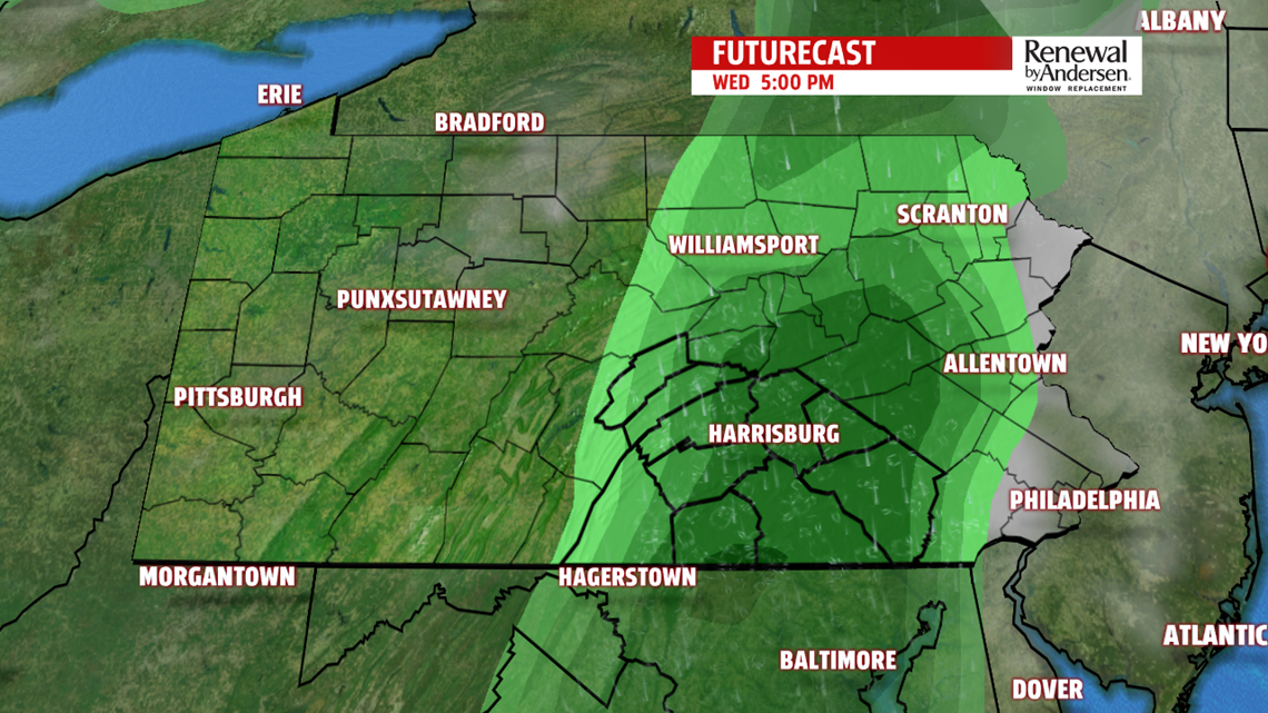
SHOWERS, THEN STORMS: We start Tuesday dry and cloudy, but spotty showers develop by the early afternoon. Not everyone will see them, but everyone will have the same low chance of needing the umbrella. Highs stay in the mid-70s. Wednesday morning lows dip into the mid-60s. More showers and storms area likely late Wednesday morning and into the afternoon. These will be more organized and widespread. Highs near 80-degrees. A few showers may linger into the overnight time frame before drying out early Thursday, if not before.


WARMING TO FINISH: Warmer air returns heading into Thurdsay and Friday. Mostly sunny, dry skies dominate the end of the work week. Highs rise into the low-to-mid 80s through Saturday with mostly sunny-to-partly cloudy skies. We stay dry until the latter half of Labor Day Weekend with rain chances returning by Sunday.
Stay “Weather Smart” with the FOX43 Weather Team all week long!
-Meteorologist Bradon Long
