

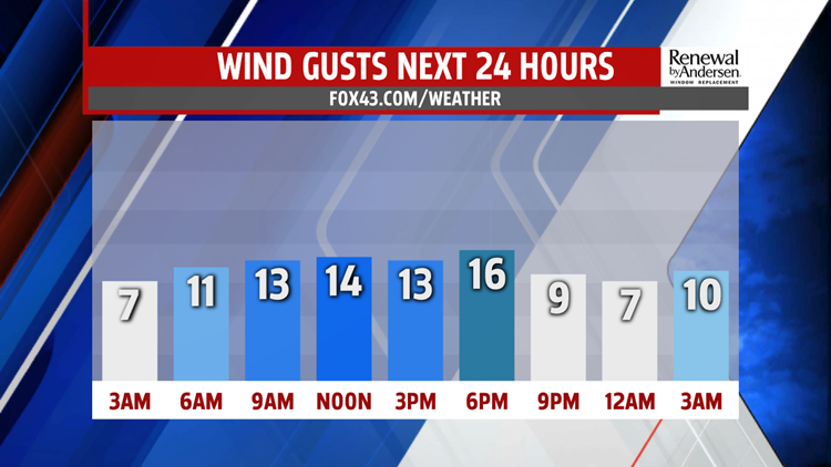


A BIT BREEZY: Westerly breezes inhibit temperatures this afternoon. Highs reach the low-40s with partly-to-mostly sunny skies. Winds gust to around 15MPH, but we stay dry. Overnight lows dip into the upper-20s for most on an otherwise mostly quiet start to the new decade. Breezes calm a bit overnight as well.

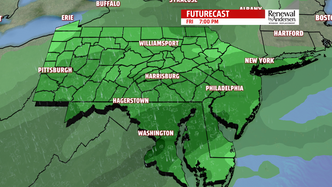
WARMING, RAIN CHANCE BEGINS: We stay dry Thursday with a bit of a temperature jump as the breezes die away. Highs hit the upper-40s under partly-to-mostly sunny skies. Clouds increase late in the day and especially during the overnight. Rain begins likely before sunrise Friday morning. Showers continue off-and-on throughout the day. Highs hit near-50 degrees with nearly overcast skies all day long. Off-and-on showers continue into Saturday morning before decreasing in the afternoon. Highs again hit the low-50s after a Saturday start in the low-to-mid 40s. Even with decreasing shower activity Saturday, we stay cloudy progressing into Sunday.

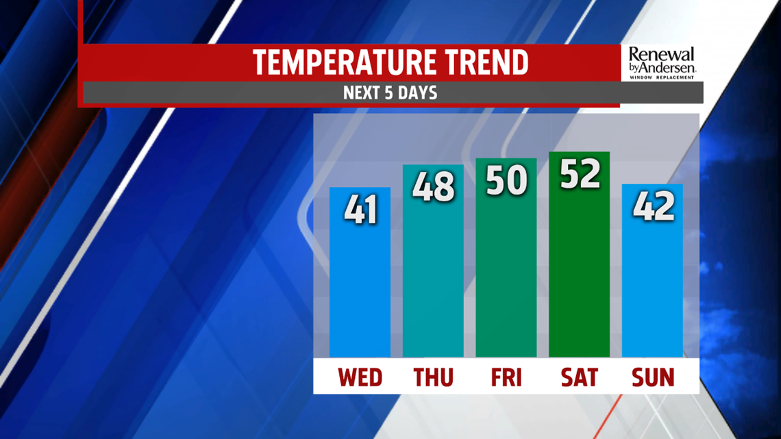
HEADING INTO NEXT WEEK: Breezy conditions move in on the back side of the storm system heading into Sunday. High temperatures stay in the low-to-mid 40s, but wind chills will be a bit of a factor throughout the day. A few flurries will be possible, especially in the morning with lows near freezing. Partly-to-mostly cloudy skies continue heading into next week with highs staying in the low-40s by Monday.
Stay “Weather Smart” with the FOX43 Weather Team all week long!
-Meteorologist Bradon Long
