

FALL FEEL STICKS AROUND

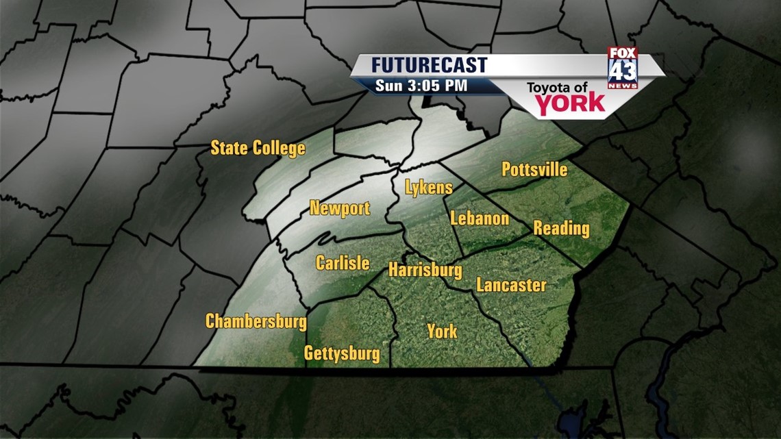
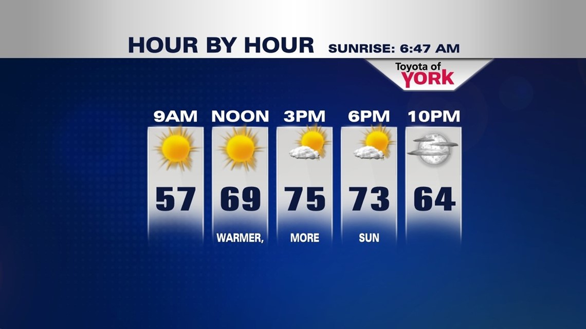
A cool, Canadian area of high pressure has brought forth a very autumn-like day. Though temperatures warm a bit through the rest of the weekend, the region will still run a few degrees below average. Tonight temperatures tumble under plenty of clear skies. It’s another night where lows fall into the 40s for most. Plenty of sunshine on Sunday, along with a shift to a warmer wind flow, helps warm temperatures quickly through the day. Highs reach the lower to middle 70s during the afternoon. You may need a jacket for Sunday morning services, but by the afternoon, you can leave it in the closet. A weak cold front approaches from the west, and this builds clouds a bit late in the day and through the evening.
SMALL BUMP IN THE ROAD
The cold front continues to advance this way overnight Sunday, thickening the clouds and bringing a shower chance late. During the morning, the front moves across the area, so clouds and showers are expected to begin the new workweek. During the afternoon, skies clear as the front gradually passes through. Tuesday remains sunny and fall-like again. High temperatures fall into the lower 70s both days. Wednesday we warm up a bit under partly cloudy skies. Highs reach the lower to middle 70s.
TURNING UNSETTLED
A frontal system approaches from the west through the rest of the week. Thursday is mainly dry, with a small shower and thunderstorm chance late in the day. Friday, a better chance for showers and thunderstorms presents itself. Saturday is still unsettled as a cold front passes through. Temperatures hover in the upper 70s to 80 degree mark through week’s end.
Enjoy the rest of your weekend!
-Andrea Michaels