
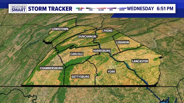
Weather Conditions for Harrisburg, York, Lancaster, Lebanon Pennsylvania, and surrounding areas.
Right Now
67
Sunny
Feels like: 67°
Humidity: 27%
none: 0%
Wind: 9 mph S
Forecast from FOX43

Weather News
- New color-coded heat risk tool adds a level higher than red
- Un helado inicio de lunes que después se transforma en temperaturas de primavera, retornando a los 60s
- Día de la tierra | ¿Porque lo celebramos?
- 'The future of conservation is landscaping:' Challenging the traditional backyard stereotype for more sustainable options | Climate Smart
10-Day Forecast
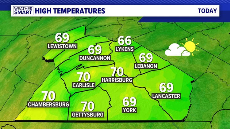
Tue
Apr 23
70
52
0%
9
MPH
WNW
Times of sun and clouds. Highs in the low 70s and lows in the mid 50s.
49%
High
6:16 AM
7:54 PM
Wed
Apr 24
67
38
20%
14
MPH
WNW
Times of sun and clouds. Highs in the mid 60s and lows in the upper 30s.
53%
High
6:14 AM
7:55 PM
Thu
Apr 25
61
37
0%
6
MPH
NNW
Sunny. Highs in the low 60s and lows in the upper 30s.
52%
High
6:13 AM
7:56 PM
Fri
Apr 26
65
43
0%
11
MPH
SE
Mostly sunny. Highs in the mid 60s and lows in the low 40s.
53%
High
6:12 AM
7:57 PM
Sat
Apr 27
66
52
30%
11
MPH
SSE
Showers ending by midday. Highs in the low 60s and lows in the low 50s.
55%
Moderate
6:10 AM
7:58 PM
Sun
Apr 28
77
60
20%
9
MPH
WSW
Mostly cloudy. Highs in the low 80s and lows in the low 60s.
59%
High
6:09 AM
7:59 PM
Mon
Apr 29
83
57
20%
11
MPH
SSW
Times of sun and clouds. Highs in the mid 80s and lows in the low 60s.
61%
Very High
6:08 AM
8:00 PM
Tue
Apr 30
73
57
30%
11
MPH
SW
Afternoon showers and thunderstorms. Highs in the upper 70s and lows in the upper 50s.
61%
High
6:07 AM
8:01 PM
Wed
May 01
71
54
0%
11
MPH
WNW
Partly cloudy. Highs in the low 70s and lows in the mid 50s.
57%
Very High
6:05 AM
8:02 PM
Thu
May 02
73
54
0%
10
MPH
NNW
Partly cloudy. Highs in the low 70s and lows in the mid 50s.
51%
High
6:04 AM
8:03 PM
Hourly Forecast
1 PM
Tue
66°
0%
9
MPH
S
2 PM
Tue
68°
0%
12
MPH
SSW
3 PM
Tue
69°
0%
13
MPH
SSW
4 PM
Tue
70°
0%
13
MPH
SSW
5 PM
Tue
70°
0%
12
MPH
SSW
6 PM
Tue
69°
0%
12
MPH
SSW
7 PM
Tue
68°
0%
10
MPH
S
8 PM
Tue
64°
0%
8
MPH
SSE
9 PM
Tue
61°
20%
8
MPH
SSE
10 PM
Tue
59°
20%
8
MPH
SSE
11 PM
Tue
57°
20%
8
MPH
SSE
12 AM
Wed
57°
20%
7
MPH
S